River Edge night lights from space
Night Light of River Edge (New Jersey) from space (United States) Src. Average luminocity for 10x10km area is 91.1105% and for 50x50km: 78.7263%.
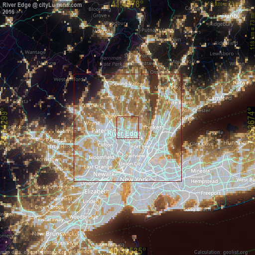
Analysis of River Edge night lights 2016
Square area 10x10 km:
 31.8%
31.8%90-99
33.16%80-89
16.84%70-79
12.93%60-69
3.91%50-59
1.36%40-49
0%30-39
0%20-29
0%10-19
0%0-9
0%Square area 50x50 km:
32.15%90-99
17.71%80-89
7.91%70-79
10.61%60-69
12.29%50-59
6.04%40-49
3.22%30-39
2.95%20-29
3.13%10-19
1.62%0-9
2.37%Clear (daylight) street map image can be seen on geolist.org.
Map coordinates:
41° 27' 28.1" North, 74° 44' 34.8" West
40° 55' 43.4" North, 74° 2' 23.5" West
40° 23' 43.3" North, 73° 20' 12.3" West
Some cities around River Edge sort by population:
• Teaneck
4 km =2.5 mi,  149°
149°
• Bergenfield
3.6 km =2.2 mi,  91°
91°
• Paramus
3.5 km =2.2 mi,  300°
300°
• Dumont
3.9 km =2.4 mi,  69°
69°
• New Milford
1.9 km =1.2 mi, 67°
• Maywood
3.4 km =2.1 mi,  212°
212°
• Oradell
3.3 km =2.1 mi,  4°
4°
• Rochelle Park
3.8 km =2.4 mi,  231°
231°
5103301 (p: 11,668)
Sources (retrieved 2019-11-25):
» Earth at Night: Flat Maps 2012, 2016