Maywood night lights from space
Night Light of Maywood (New Jersey) from space (United States) Src. Average luminocity for 10x10km area is 96.6531% and for 50x50km: 81.064%.
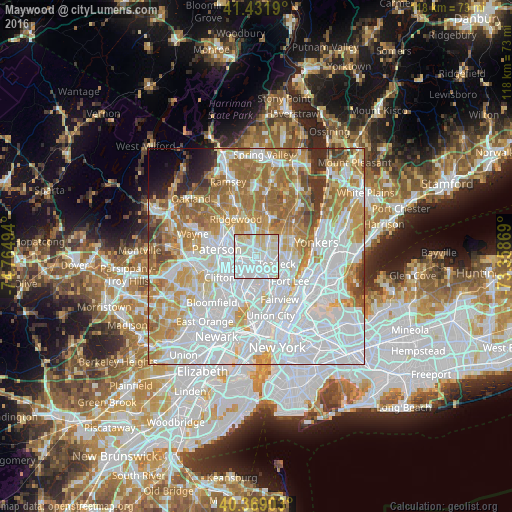
Analysis of Maywood night lights 2016
Square area 10x10 km:
 51.19%
90-99
36.22%80-89
11.39%70-79
1.19%60-69
0%50-59
0%40-49
0%30-39
0%20-29
0%10-19
0%0-9
0%Square area 50x50 km:
35.61%90-99
17.91%80-89
7.7%70-79
10.81%60-69
11.77%50-59
5.53%40-49
2.74%30-39
2.39%20-29
2.02%10-19
1.62%0-9
1.9%Clear (daylight) street map image can be seen on geolist.org.
Map coordinates:
41° 25' 54.8" North, 74° 45' 53.8" West
40° 54' 9.4" North, 74° 3' 42.5" West
40° 22' 8.5" North, 73° 21' 31.3" West
Some cities around Maywood sort by population:
• Hackensack
2.4 km =1.5 mi,  140°
140°
• Teaneck
3.9 km =2.4 mi,  98°
98°
• Lodi
2.9 km =1.8 mi,  218°
218°
• Elmwood Park
4.8 km =3 mi,  271°
271°
• Saddle Brook
2.6 km =1.6 mi,  261°
261°
• River Edge
3.4 km =2.1 mi,  32°
32°
• Bogota
4 km =2.5 mi, 137°
• Rochelle Park
1.2 km =0.7 mi,  295°
295°
5100972 (p: 9,805)
Sources (retrieved 2019-11-25):
» Earth at Night: Flat Maps 2012, 2016