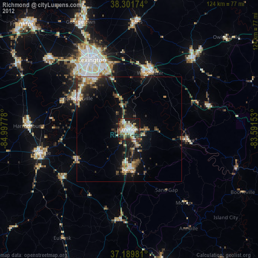
Richmond night lights from space
Night Light of Richmond (Kentucky) from space (United States) Src. Average luminocity for 10x10km area is 55.7517% and for 50x50km: 10.6405%.

Analysis of Richmond night lights 2016
Square area 10x10 km:
 9.86%
9.86%90-99
13.1%80-89
5.78%70-79
5.61%60-69
9.86%50-59
5.95%40-49
10.71%30-39
13.61%20-29
16.33%10-19
9.01%0-9
0.17%Square area 50x50 km:
0.96%90-99
1.52%80-89
1%70-79
0.9%60-69
1.37%50-59
1.42%40-49
1.97%30-39
2.71%20-29
4.58%10-19
8.58%0-9
74.97%Clear (daylight) street map image can be seen on geolist.org.
Map coordinates:
38° 18' 6.3" North, 84° 59' 52" West
37° 44' 52.3" North, 84° 17' 40.7" West
37° 11' 23.3" North, 83° 35' 29.5" West
Some cities around Richmond sort by population:
• Lexington-Fayette
36.5 km =22.7 mi,  336°
336°
• Lexington
31.2 km =19.4 mi,  329°
329°
• Nicholasville
28.6 km =17.8 mi,  301°
301°
• Winchester
28.8 km =17.9 mi,  20°
20°
• Danville
43.5 km =27 mi,  254°
254°
• Berea
19.9 km =12.4 mi,  180°
180°
• Wilmore
34.6 km =21.5 mi,  291°
291°
• Monticello
35.2 km =21.9 mi,  320°
320°
4305974 (p: 33,533)
Sources (retrieved 2019-11-25):
» Earth at Night: Flat Maps 2012, 2016