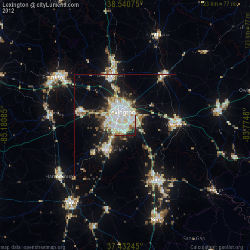
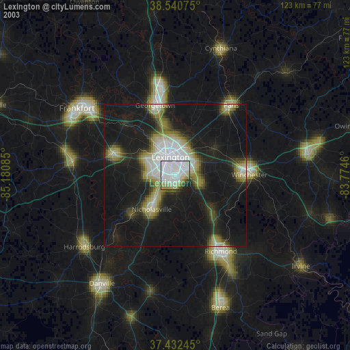
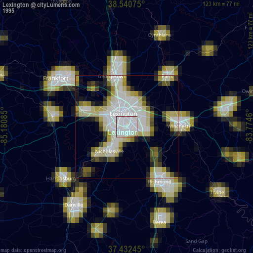
Lexington night lights from space
Night Light of Lexington (Kentucky) from space (United States) Src. Average luminocity for 10x10km area is 84.7808% and for 50x50km: 22.0352%.
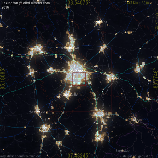
Analysis of Lexington night lights 2016
Square area 10x10 km:
 31.82%
90-99
35.55%80-89
7.31%70-79
4.87%60-69
4.38%50-59
2.76%40-49
2.76%30-39
4.22%20-29
5.68%10-19
0.65%0-9
0%Square area 50x50 km:
4.32%90-99
4.92%80-89
2.52%70-79
2.09%60-69
1.97%50-59
1.91%40-49
2.54%30-39
3.4%20-29
6.52%10-19
12.52%0-9
57.29%Clear (daylight) street map image can be seen on geolist.org.
Map coordinates:
38° 32' 26.7" North, 85° 10' 51.1" West
37° 59' 19.3" North, 84° 28' 39.8" West
37° 25' 56.8" North, 83° 46' 28.6" West
Some cities around Lexington sort by population:
• Richmond
31.2 km =19.4 mi,  149°
149°
• Georgetown
25.6 km =15.9 mi,  343°
343°
• Nicholasville
14.6 km =9.1 mi,  214°
214°
• Winchester
26.1 km =16.2 mi,  89°
89°
• Paris
31.5 km =19.6 mi,  38°
38°
• Versailles
23.2 km =14.4 mi,  287°
287°
• Wilmore
21.4 km =13.3 mi,  228°
228°
• Monticello
6.4 km =4 mi,  273°
273°
4297983 (p: 225,366)
Sources (retrieved 2019-11-25):
» NASA, Earths city lights 1995
» NASA city lights 2003
» Earth at Night: Flat Maps 2012, 2016