Winchester night lights from space
Night Light of Winchester (Kentucky) from space (United States) Src. Average luminocity for 10x10km area is 38.0958% and for 50x50km: 10.808%.
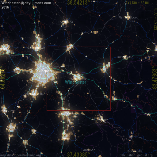
Analysis of Winchester night lights 2016
Square area 10x10 km:
 6.01%
6.01%90-99
8.12%80-89
5.84%70-79
4.87%60-69
4.87%50-59
4.06%40-49
3.41%30-39
5.52%20-29
7.14%10-19
28.41%0-9
21.75%Square area 50x50 km:
1.5%90-99
1.93%80-89
1.26%70-79
1.15%60-69
1.07%50-59
1.1%40-49
1.33%30-39
1.93%20-29
2.89%10-19
8.24%0-9
77.6%Clear (daylight) street map image can be seen on geolist.org.
Map coordinates:
38° 32' 31.7" North, 84° 52' 58" West
37° 59' 24.3" North, 84° 10' 46.7" West
37° 26' 1.9" North, 83° 28' 35.5" West
Some cities around Winchester sort by population:
• Lexington-Fayette
25.3 km =15.7 mi,  285°
285°
• Lexington
26.1 km =16.2 mi,  269°
269°
• Richmond
28.8 km =17.9 mi,  200°
200°
• Georgetown
41.2 km =25.6 mi,  306°
306°
• Nicholasville
36.6 km =22.7 mi,  250°
250°
• Paris
25.3 km =15.7 mi,  345°
345°
• Mount Sterling
22 km =13.7 mi,  70°
70°
• Monticello
32.5 km =20.2 mi, 270°
4313697 (p: 18,446)
Sources (retrieved 2019-11-25):
» Earth at Night: Flat Maps 2012, 2016