Lexington-Fayette night lights from space
Night Light of Lexington-Fayette (Kentucky) from space (United States) Src. Average luminocity for 10x10km area is 87.9497% and for 50x50km: 22.9859%.
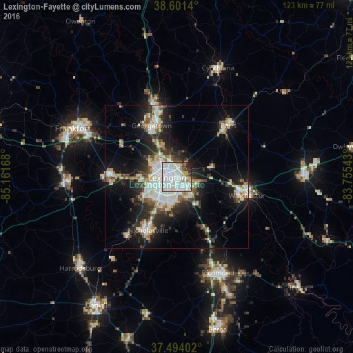
Analysis of Lexington-Fayette night lights 2016
Square area 10x10 km:
 38.15%
90-99
34.74%80-89
5.68%70-79
6.01%60-69
2.76%50-59
2.44%40-49
3.25%30-39
2.44%20-29
3.41%10-19
1.14%0-9
0%Square area 50x50 km:
4.58%90-99
5.26%80-89
2.66%70-79
2.18%60-69
2.11%50-59
2.08%40-49
2.56%30-39
3.52%20-29
6.46%10-19
12.4%0-9
56.19%Clear (daylight) street map image can be seen on geolist.org.
Map coordinates:
38° 36' 5" North, 85° 9' 42" West
38° 2' 59.3" North, 84° 27' 30.8" West
37° 29' 38.5" North, 83° 45' 19.5" West
Some cities around Lexington-Fayette sort by population:
• Richmond
36.5 km =22.7 mi,  156°
156°
• Georgetown
19.8 km =12.3 mi,  333°
333°
• Nicholasville
21.3 km =13.2 mi,  208°
208°
• Winchester
25.3 km =15.7 mi,  105°
105°
• Paris
25.3 km =15.7 mi,  45°
45°
• Versailles
23.8 km =14.8 mi,  270°
270°
• Wilmore
27.4 km =17 mi,  220°
220°
• Monticello
10.3 km =6.4 mi,  231°
231°
4297999 (p: 314,488)
Sources (retrieved 2019-11-25):
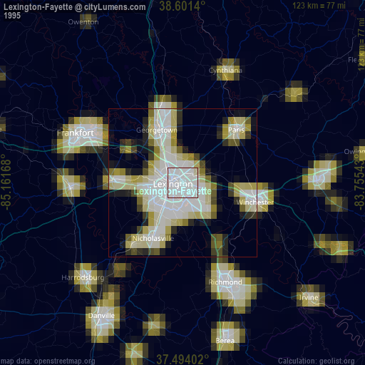
» NASA, Earths city lights 1995
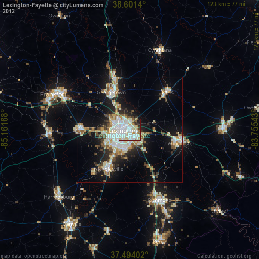
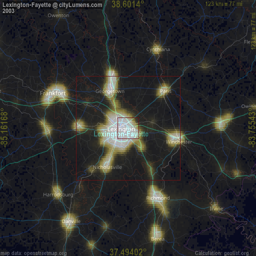
» NASA city lights 2003
» Earth at Night: Flat Maps 2012, 2016