Rahway night lights from space
Night Light of Rahway (New Jersey) from space (United States) Src. Average luminocity for 10x10km area is 96.2029% and for 50x50km: 74.556%.

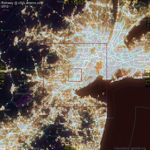
Analysis of Rahway night lights 2016
Square area 10x10 km:
 49.68%
90-99
31.98%80-89
15.91%70-79
2.44%60-69
0%50-59
0%40-49
0%30-39
0%20-29
0%10-19
0%0-9
0%Square area 50x50 km:
27.5%90-99
18.19%80-89
8.56%70-79
10.62%60-69
9.27%50-59
6.36%40-49
3.89%30-39
3.54%20-29
4.54%10-19
4%0-9
3.53%Clear (daylight) street map image can be seen on geolist.org.
Map coordinates:
41° 8' 23.4" North, 74° 58' 50.8" West
40° 36' 29.4" North, 74° 16' 39.5" West
40° 4' 20" North, 73° 34' 28.3" West
Some cities around Rahway sort by population:
• Linden
3.2 km =2 mi,  61°
61°
• Carteret
5.4 km =3.4 mi,  129°
129°
• Roselle
5.2 km =3.2 mi,  17°
17°
• Woodbridge
5.7 km =3.5 mi,  185°
185°
• Iselin
5.2 km =3.2 mi,  226°
226°
• Colonia
4.3 km =2.7 mi,  208°
208°
• Avenel
3.2 km =2 mi, 191°
• Clark
4.6 km =2.9 mi,  322°
322°
5103055 (p: 29,508)
Sources (retrieved 2019-11-25):
» Earth at Night: Flat Maps 2012, 2016