Quincy night lights from space
Night Light of Quincy (Florida) from space (United States) Src. Average luminocity for 10x10km area is 27.3352% and for 50x50km: 6.8478%.
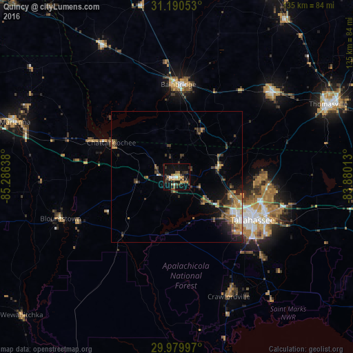
Analysis of Quincy night lights 2016
Square area 10x10 km:
 2.38%
2.38%90-99
1.28%80-89
1.83%70-79
8.61%60-69
4.58%50-59
3.3%40-49
2.2%30-39
7.51%20-29
5.68%10-19
33.15%0-9
29.49%Square area 50x50 km:
0.52%90-99
0.7%80-89
0.34%70-79
1.45%60-69
1.67%50-59
0.86%40-49
1.03%30-39
1.53%20-29
1.91%10-19
4.03%0-9
85.96%Clear (daylight) street map image can be seen on geolist.org.
Map coordinates:
31° 11' 25.9" North, 85° 17' 11" West
30° 35' 13.7" North, 84° 34' 59.7" West
29° 58' 47.9" North, 83° 52' 48.5" West
Some cities around Quincy sort by population:
• Tallahassee
33.4 km =20.8 mi,  119°
119°
• Dothan
104.6 km =65 mi,  312°
312°
• Thomasville
64.1 km =39.8 mi,  64°
64°
• Moultrie
100.4 km =62.4 mi,  48°
48°
• Bainbridge
35.2 km =21.9 mi,  1°
1°
• Cairo
48.7 km =30.3 mi, 48°
• Marianna
65 km =40.4 mi,  288°
288°
• Camilla
80 km =49.7 mi,  26°
26°
4169510 (p: 7,830)
Sources (retrieved 2019-11-25):
» Earth at Night: Flat Maps 2012, 2016