Dothan night lights from space
Night Light of Dothan (Alabama) from space (United States) Src. Average luminocity for 10x10km area is 81.4194% and for 50x50km: 12.6991%.
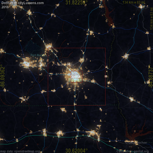
Analysis of Dothan night lights 2016
Square area 10x10 km:
 30.04%
90-99
24.54%80-89
6.41%70-79
11.9%60-69
10.99%50-59
1.47%40-49
6.23%30-39
2.75%20-29
5.68%10-19
0%0-9
0%Square area 50x50 km:
1.43%90-99
1.3%80-89
1%70-79
2.57%60-69
2.42%50-59
1.21%40-49
2.01%30-39
3.59%20-29
3.64%10-19
6.6%0-9
74.23%Clear (daylight) street map image can be seen on geolist.org.
Map coordinates:
31° 49' 21.3" North, 86° 5' 37" West
31° 13' 23.6" North, 85° 23' 25.8" West
30° 37' 12.1" North, 84° 41' 14.5" West
Some cities around Dothan sort by population:
• Enterprise
45.3 km =28.1 mi,  283°
283°
• Troy
85.2 km =52.9 mi,  319°
319°
• Ozark
35.4 km =22 mi, 317°
• Eufaula
77.8 km =48.3 mi,  17°
17°
• Bainbridge
85.4 km =53.1 mi,  114°
114°
• Marianna
52.3 km =32.5 mi,  162°
162°
• Opp
82.5 km =51.3 mi,  274°
274°
• Daleville
32.1 km =19.9 mi,  287°
287°
4059102 (p: 68,567)
Sources (retrieved 2019-11-25):
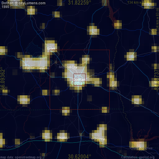
» NASA, Earths city lights 1995
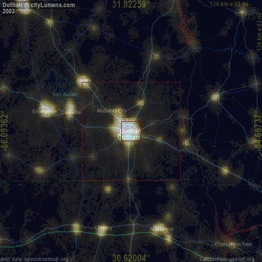
» NASA city lights 2003
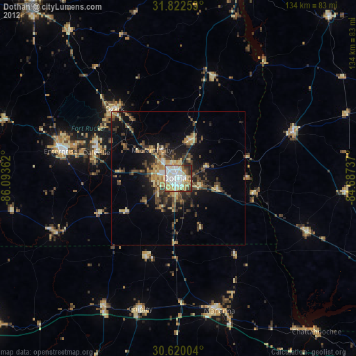
» Earth at Night: Flat Maps 2012, 2016