Camilla night lights from space
Night Light of Camilla (Georgia) from space (United States) Src. Average luminocity for 10x10km area is 25.8388% and for 50x50km: 3.1251%.
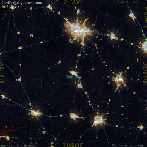
Analysis of Camilla night lights 2016
Square area 10x10 km:
 4.4%
4.4%90-99
3.11%80-89
2.2%70-79
6.78%60-69
3.3%50-59
1.28%40-49
1.1%30-39
0.92%20-29
3.85%10-19
37.18%0-9
35.9%Square area 50x50 km:
0.22%90-99
0.21%80-89
0.17%70-79
0.74%60-69
0.46%50-59
0.39%40-49
0.5%30-39
0.56%20-29
0.58%10-19
2.65%0-9
93.53%Clear (daylight) street map image can be seen on geolist.org.
Map coordinates:
31° 49' 50.2" North, 84° 54' 48.9" West
31° 13' 52.6" North, 84° 12' 37.7" West
30° 37' 41.4" North, 83° 30' 26.4" West
Some cities around Camilla sort by population:
• Albany
39 km =24.2 mi,  7°
7°
• Thomasville
49.1 km =30.5 mi,  153°
153°
• Tifton
71 km =44.1 mi,  69°
69°
• Moultrie
40.5 km =25.2 mi,  98°
98°
• Bainbridge
50.3 km =31.3 mi,  223°
223°
• Cairo
39.3 km =24.4 mi,  178°
178°
• Sylvester
48.7 km =30.3 mi,  46°
46°
• Adel
75.5 km =46.9 mi, 97°
4185863 (p: 5,089)
Sources (retrieved 2019-11-25):
» Earth at Night: Flat Maps 2012, 2016