Putnam night lights from space
Night Light of Putnam (Connecticut) from space (United States) Src. Average luminocity for 10x10km area is 23.1143% and for 50x50km: 8.3556%.
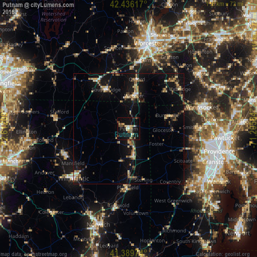
Analysis of Putnam night lights 2016
Square area 10x10 km:
 0.95%
0.95%90-99
2.7%80-89
3.17%70-79
5.4%60-69
1.43%50-59
3.81%40-49
3.97%30-39
2.06%20-29
3.02%10-19
34.44%0-9
39.05%Square area 50x50 km:
0.4%90-99
0.74%80-89
1.49%70-79
0.92%60-69
1.09%50-59
1.17%40-49
1.17%30-39
1.01%20-29
2.01%10-19
9.09%0-9
80.92%Clear (daylight) street map image can be seen on geolist.org.
Map coordinates:
42° 26' 10.2" North, 72° 36' 43.5" West
41° 54' 54.4" North, 71° 54' 32.3" West
41° 23' 23.1" North, 71° 12' 21" West
Some cities around Putnam sort by population:
• Southbridge
20.5 km =12.7 mi,  329°
329°
• Killingly Center
9.1 km =5.7 mi,  158°
158°
• Charlton
25 km =15.5 mi,  348°
348°
• Webster
15.2 km =9.4 mi,  9°
9°
• Dudley
14.6 km =9.1 mi, 353°
• Thompson
6.2 km =3.9 mi,  38°
38°
• Douglas
20.9 km =13 mi, 42°
• Oxford
22.7 km =14.1 mi, 9°
4841187 (p: 7,214)
Sources (retrieved 2019-11-25):
» Earth at Night: Flat Maps 2012, 2016