Oxford night lights from space
Night Light of Oxford (Massachusetts) from space (United States) Src. Average luminocity for 10x10km area is 21.0803% and for 50x50km: 20.5122%.
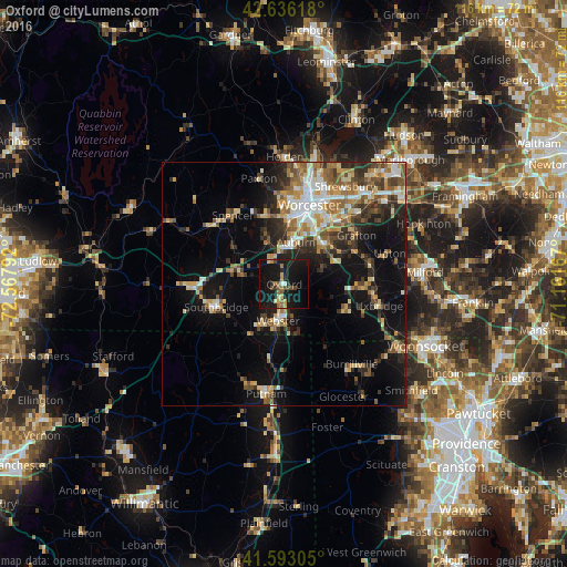
Analysis of Oxford night lights 2016
Square area 10x10 km:
 0.61%
0.61%90-99
0.61%80-89
3.79%70-79
2.27%60-69
3.18%50-59
3.18%40-49
3.33%30-39
0.91%20-29
3.79%10-19
49.85%0-9
28.48%Square area 50x50 km:
2.4%90-99
3.04%80-89
2.97%70-79
2.53%60-69
3.2%50-59
3.17%40-49
2.69%30-39
3.06%20-29
5.33%10-19
13.64%0-9
57.97%Clear (daylight) street map image can be seen on geolist.org.
Map coordinates:
42° 38' 10.2" North, 72° 34' 4.5" West
42° 7' 0.3" North, 71° 51' 53.2" West
41° 35' 35" North, 71° 9' 42" West
Some cities around Oxford sort by population:
• Southbridge
14.7 km =9.1 mi,  251°
251°
• Auburn
9 km =5.6 mi,  15°
15°
• Millbury
12.2 km =7.6 mi,  45°
45°
• Charlton
8.9 km =5.5 mi,  283°
283°
• Webster
7.5 km =4.7 mi,  189°
189°
• Dudley
9.6 km =6 mi,  214°
214°
• Sutton
9.2 km =5.7 mi,  66°
66°
• Douglas
12.5 km =7.8 mi,  123°
123°
4946546 (p: 6,103)
Sources (retrieved 2019-11-25):
» Earth at Night: Flat Maps 2012, 2016