Douglas night lights from space
Night Light of Douglas (Massachusetts) from space (United States) Src. Average luminocity for 10x10km area is 5.5778% and for 50x50km: 25.3902%.
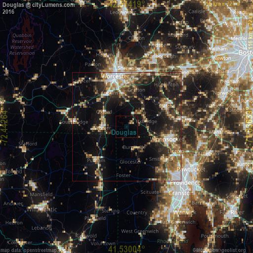
Analysis of Douglas night lights 2016
Square area 10x10 km:
 0%
0%90-99
0.79%80-89
1.11%70-79
0.63%60-69
0.63%50-59
0.63%40-49
0%30-39
0.79%20-29
1.11%10-19
5.24%0-9
89.05%Square area 50x50 km:
2.84%90-99
3.51%80-89
3.32%70-79
3.01%60-69
3.74%50-59
4.42%40-49
4.03%30-39
4.96%20-29
8.39%10-19
16.75%0-9
45.02%Clear (daylight) street map image can be seen on geolist.org.
Map coordinates:
42° 34' 27.1" North, 72° 26' 33.5" West
42° 3' 15.3" North, 71° 44' 22.2" West
41° 31' 48.1" North, 71° 2' 11" West
Some cities around Douglas sort by population:
• Northbridge
13.1 km =8.1 mi,  34°
34°
• Millbury
15.6 km =9.7 mi,  353°
353°
• Uxbridge
9.4 km =5.8 mi,  74°
74°
• Webster
11.6 km =7.2 mi,  267°
267°
• Thompson
14.7 km =9.1 mi,  223°
223°
• Sutton
10.8 km =6.7 mi, 349°
• Whitinsville
8.8 km =5.5 mi,  43°
43°
• Oxford
12.5 km =7.8 mi,  303°
303°
4934999 (p: 7,168)
Sources (retrieved 2019-11-25):
» Earth at Night: Flat Maps 2012, 2016