Punta Gorda Isles night lights from space
Night Light of Punta Gorda Isles (Florida) from space (United States) Src. Average luminocity for 10x10km area is 40.131% and for 50x50km: 22.5323%.
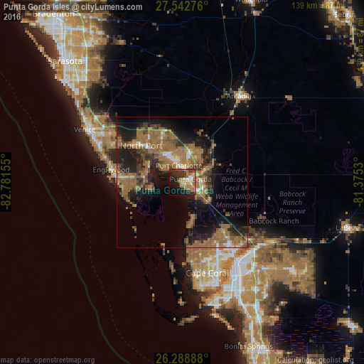
Analysis of Punta Gorda Isles night lights 2016
Square area 10x10 km:
 2.58%
2.58%90-99
4.76%80-89
2.38%70-79
7.54%60-69
17.06%50-59
4.76%40-49
2.18%30-39
10.71%20-29
15.48%10-19
19.84%0-9
12.7%Square area 50x50 km:
1.09%90-99
1.43%80-89
1.12%70-79
1.78%60-69
10.46%50-59
6.92%40-49
3.12%30-39
4.61%20-29
6.51%10-19
13.13%0-9
49.84%Clear (daylight) street map image can be seen on geolist.org.
Map coordinates:
27° 32' 33.9" North, 82° 46' 53.6" West
26° 55' 3.2" North, 82° 4' 42.3" West
26° 17' 20" North, 81° 22' 31.1" West
Some cities around Punta Gorda Isles sort by population:
• North Port
21 km =13 mi,  312°
312°
• Port Charlotte
6.6 km =4.1 mi,  349°
349°
• North Fort Myers
34.1 km =21.2 mi,  144°
144°
• Englewood
27.6 km =17.1 mi,  280°
280°
• Rotonda West
21.3 km =13.2 mi,  259°
259°
• Venice Gardens
36.9 km =22.9 mi,  297°
297°
• Southeast Arcadia
37.4 km =23.2 mi,  36°
36°
• Warm Mineral Springs
24 km =14.9 mi, 311°
4169455 (p: 18,306)
Sources (retrieved 2019-11-25):
» Earth at Night: Flat Maps 2012, 2016