North Port night lights from space
Night Light of North Port (Florida) from space (United States) Src. Average luminocity for 10x10km area is 51.5317% and for 50x50km: 25.6464%.
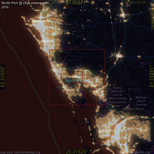
Analysis of North Port night lights 2016
Square area 10x10 km:
 4.17%
4.17%90-99
4.56%80-89
1.59%70-79
3.17%60-69
27.58%50-59
17.46%40-49
7.74%30-39
10.71%20-29
14.29%10-19
8.73%0-9
0%Square area 50x50 km:
1.56%90-99
2.37%80-89
1.72%70-79
2.65%60-69
11.68%50-59
6.54%40-49
3.29%30-39
4.32%20-29
7.72%10-19
12.96%0-9
45.19%Clear (daylight) street map image can be seen on geolist.org.
Map coordinates:
27° 40' 7.4" North, 82° 56' 20.6" West
27° 2' 39.2" North, 82° 14' 9.3" West
26° 24' 58.5" North, 81° 31' 58.1" West
Some cities around North Port sort by population:
• Port Charlotte
16.3 km =10.1 mi,  117°
117°
• Venice
22.5 km =14 mi,  285°
285°
• Punta Gorda Isles
21 km =13 mi,  132°
132°
• Englewood
14.7 km =9.1 mi,  231°
231°
• South Venice
18.7 km =11.6 mi,  273°
273°
• Rotonda West
18.6 km =11.6 mi,  196°
196°
• Venice Gardens
17.3 km =10.7 mi,  280°
280°
• Warm Mineral Springs
3 km =1.9 mi,  305°
305°
4166274 (p: 62,345)
Sources (retrieved 2019-11-25):
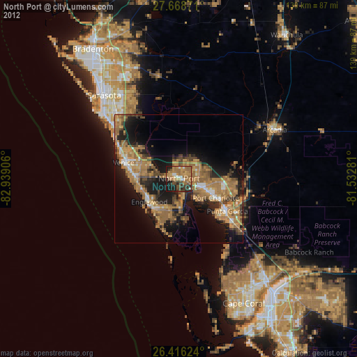
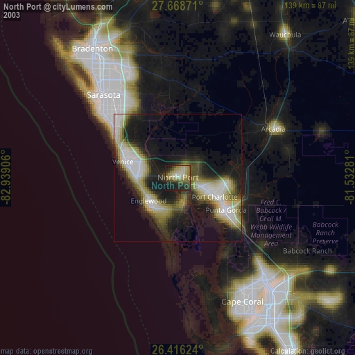
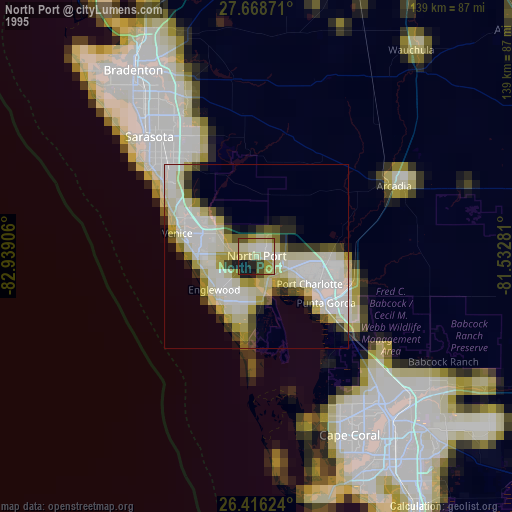
» NASA, Earths city lights 1995
» NASA city lights 2003
» Earth at Night: Flat Maps 2012, 2016