Venice Gardens night lights from space
Night Light of Venice Gardens (Florida) from space (United States) Src. Average luminocity for 10x10km area is 67.4028% and for 50x50km: 20.3093%.
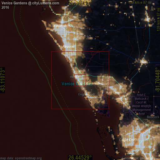
Analysis of Venice Gardens night lights 2016
Square area 10x10 km:
 10.91%
90-99
14.88%80-89
6.94%70-79
12.5%60-69
28.17%50-59
7.14%40-49
3.17%30-39
2.18%20-29
9.13%10-19
4.96%0-9
0%Square area 50x50 km:
1.53%90-99
2.22%80-89
1.48%70-79
1.98%60-69
8.44%50-59
4.4%40-49
2.63%30-39
3.19%20-29
7.03%10-19
11.15%0-9
55.95%Clear (daylight) street map image can be seen on geolist.org.
Map coordinates:
27° 41' 50.7" North, 83° 6' 38.6" West
27° 4' 23.2" North, 82° 24' 27.4" West
26° 26' 43" North, 81° 42' 16.1" West
Some cities around Venice Gardens sort by population:
• North Port
17.3 km =10.7 mi,  100°
100°
• Englewood
13.5 km =8.4 mi,  156°
156°
• South Venice
2.8 km =1.7 mi,  216°
216°
• Gulf Gate Estates
22.5 km =14 mi,  331°
331°
• Rotonda West
24.1 km =15 mi,  151°
151°
• Laurel
9.5 km =5.9 mi, 325°
• Osprey
15.9 km =9.9 mi, 329°
• Warm Mineral Springs
14.7 km =9.1 mi, 95°
4176387 (p: 7,104)
Sources (retrieved 2019-11-25):
» Earth at Night: Flat Maps 2012, 2016