Prairie View night lights from space
Night Light of Prairie View (Texas) from space (United States) Src. Average luminocity for 10x10km area is 27.3598% and for 50x50km: 11.6698%.
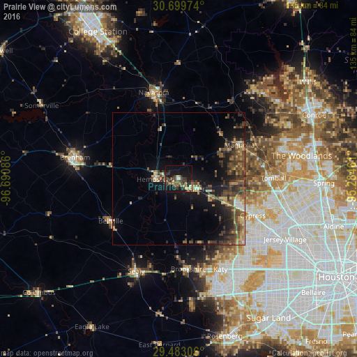
Analysis of Prairie View night lights 2016
Square area 10x10 km:
 1.14%
1.14%90-99
0.38%80-89
3.98%70-79
3.41%60-69
5.3%50-59
3.79%40-49
7.77%30-39
7.77%20-29
10.98%10-19
33.71%0-9
21.78%Square area 50x50 km:
0.43%90-99
0.52%80-89
1.72%70-79
1.7%60-69
1.56%50-59
2.15%40-49
3.52%30-39
3.88%20-29
3.45%10-19
8.76%0-9
72.32%Clear (daylight) street map image can be seen on geolist.org.
Map coordinates:
30° 41' 59.1" North, 96° 41' 27.1" West
30° 5' 35.8" North, 95° 59' 15.8" West
29° 28' 59" North, 95° 17' 4.6" West
Some cities around Prairie View sort by population:
• Cypress
31.2 km =19.4 mi,  116°
116°
• Brenham
40.3 km =25 mi,  281°
281°
• Katy
37.6 km =23.4 mi,  155°
155°
• Tomball
35.8 km =22.2 mi,  89°
89°
• Navasota
34.1 km =21.2 mi,  343°
343°
• Hempstead
8.7 km =5.4 mi,  273°
273°
• Sealy
38.4 km =23.9 mi,  205°
205°
• Brookshire
34.3 km =21.3 mi,  174°
174°
4720493 (p: 6,369)
Sources (retrieved 2019-11-25):
» Earth at Night: Flat Maps 2012, 2016