Hempstead night lights from space
Night Light of Hempstead (Texas) from space (United States) Src. Average luminocity for 10x10km area is 22.2898% and for 50x50km: 5.5665%.
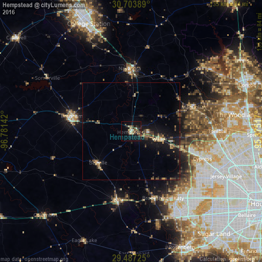
Analysis of Hempstead night lights 2016
Square area 10x10 km:
 0.38%
0.38%90-99
2.08%80-89
6.63%70-79
0%60-69
3.98%50-59
2.84%40-49
5.49%30-39
4.55%20-29
4.36%10-19
21.97%0-9
47.73%Square area 50x50 km:
0.13%90-99
0.24%80-89
0.87%70-79
0.75%60-69
0.73%50-59
0.75%40-49
1.17%30-39
1.4%20-29
1.43%10-19
5.73%0-9
86.8%Clear (daylight) street map image can be seen on geolist.org.
Map coordinates:
30° 42' 14" North, 96° 46' 53.1" West
30° 5' 50.8" North, 96° 4' 41.8" West
29° 29' 14.1" North, 95° 22' 30.6" West
Some cities around Hempstead sort by population:
• Cypress
39.4 km =24.5 mi,  111°
111°
• Brenham
31.7 km =19.7 mi,  284°
284°
• Katy
42.4 km =26.3 mi,  144°
144°
• Tomball
44.5 km =27.7 mi,  90°
90°
• Navasota
32.3 km =20.1 mi,  358°
358°
• Sealy
36 km =22.4 mi,  192°
192°
• Prairie View
8.7 km =5.4 mi, 93°
• Brookshire
36.7 km =22.8 mi,  160°
160°
4697060 (p: 7,110)
Sources (retrieved 2019-11-25):
» Earth at Night: Flat Maps 2012, 2016