Port Washington night lights from space
Night Light of Port Washington (New York) from space (United States) Src. Average luminocity for 10x10km area is 72.9847% and for 50x50km: 72.5688%.
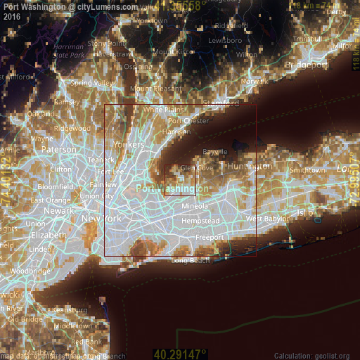
Analysis of Port Washington night lights 2016
Square area 10x10 km:
 16.33%
90-99
18.37%80-89
11.9%70-79
12.76%60-69
12.59%50-59
8.33%40-49
4.42%30-39
8.67%20-29
6.63%10-19
0%0-9
0%Square area 50x50 km:
35.49%90-99
15.22%80-89
5.05%70-79
7.02%60-69
7.98%50-59
5.29%40-49
3.53%30-39
3.09%20-29
4.23%10-19
5.79%0-9
7.31%Clear (daylight) street map image can be seen on geolist.org.
Map coordinates:
41° 21' 20.1" North, 74° 24' 4.8" West
40° 49' 32.4" North, 73° 41' 53.5" West
40° 17' 29.3" North, 72° 59' 42.3" West
Some cities around Port Washington sort by population:
• Great Neck
3.8 km =2.4 mi,  222°
222°
• Manhasset
3.1 km =1.9 mi,  182°
182°
• Great Neck Plaza
4.9 km =3 mi,  208°
208°
• Manorhaven
2.4 km =1.5 mi,  324°
324°
• Roslyn Heights
5.9 km =3.7 mi,  133°
133°
• North Hills
5.3 km =3.3 mi,  159°
159°
• Kings Point
3.2 km =2 mi,  258°
258°
• Sea Cliff
5.2 km =3.2 mi,  59°
59°
5132029 (p: 15,846)
Sources (retrieved 2019-11-25):
» Earth at Night: Flat Maps 2012, 2016