Great Neck night lights from space
Night Light of Great Neck (New York) from space (United States) Src. Average luminocity for 10x10km area is 80.8861% and for 50x50km: 74.2487%.
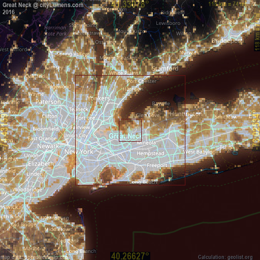
Analysis of Great Neck night lights 2016
Square area 10x10 km:
 28.74%
90-99
22.62%80-89
7.99%70-79
10.37%60-69
10.37%50-59
6.12%40-49
8.16%30-39
5.61%20-29
0%10-19
0%0-9
0%Square area 50x50 km:
37.3%90-99
16.24%80-89
4.99%70-79
6.51%60-69
7.12%50-59
5.08%40-49
3.61%30-39
3.14%20-29
4.26%10-19
5.26%0-9
6.49%Clear (daylight) street map image can be seen on geolist.org.
Map coordinates:
41° 19' 50.8" North, 74° 25' 53.7" West
40° 48' 2.4" North, 73° 43' 42.5" West
40° 15' 58.6" North, 73° 1' 31.2" West
Some cities around Great Neck sort by population:
• Bayside
5.4 km =3.4 mi,  228°
228°
• Port Washington
3.8 km =2.4 mi,  42°
42°
• Douglaston
3.9 km =2.4 mi,  203°
203°
• Little Neck
4.2 km =2.6 mi,  184°
184°
• Manhasset
2.5 km =1.6 mi,  97°
97°
• Manorhaven
4.9 km =3 mi,  13°
13°
• North Hills
4.9 km =3 mi,  116°
116°
• Kings Point
2.2 km =1.4 mi,  345°
345°
5119218 (p: 10,143)
Sources (retrieved 2019-11-25):
» Earth at Night: Flat Maps 2012, 2016