Selden night lights from space
Night Light of Selden (New York) from space (United States) Src. Average luminocity for 10x10km area is 77.9439% and for 50x50km: 33.5511%.
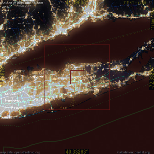
Analysis of Selden night lights 2016
Square area 10x10 km:
 9.01%
9.01%90-99
17.01%80-89
15.14%70-79
25.68%60-69
26.36%50-59
6.29%40-49
0.34%30-39
0.17%20-29
0%10-19
0%0-9
0%Square area 50x50 km:
4.57%90-99
5.86%80-89
5.11%70-79
6.84%60-69
6.69%50-59
5.79%40-49
4.33%30-39
3.11%20-29
5.7%10-19
10.35%0-9
41.66%Clear (daylight) street map image can be seen on geolist.org.
Map coordinates:
41° 23' 45.9" North, 73° 44' 19.6" West
40° 51' 59.4" North, 73° 2' 8.4" West
40° 19' 57.5" North, 72° 19' 57.1" West
Some cities around Selden sort by population:
• Coram
2.9 km =1.8 mi,  85°
85°
• Centereach
5.4 km =3.4 mi,  260°
260°
• Medford
6.2 km =3.9 mi,  151°
151°
• Holtsville
5.7 km =3.5 mi,  187°
187°
• Farmingville
4 km =2.5 mi,  172°
172°
• Terryville
5.3 km =3.3 mi,  332°
332°
• Lake Grove
6.9 km =4.3 mi, 257°
• Port Jefferson Station
6.6 km =4.1 mi,  351°
351°
5137600 (p: 19,851)
Sources (retrieved 2019-11-25):
» Earth at Night: Flat Maps 2012, 2016