Lauderdale-by-the-Sea night lights from space
Night Light of Lauderdale-by-the-Sea (Florida) from space (United States) Src. Average luminocity for 10x10km area is 68.1687% and for 50x50km: 47.7681%.
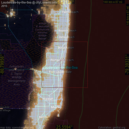
Analysis of Lauderdale-by-the-Sea night lights 2016
Square area 10x10 km:
 45.83%
90-99
5.95%80-89
0.6%70-79
0.4%60-69
2.38%50-59
7.14%40-49
8.13%30-39
8.13%20-29
7.74%10-19
13.69%0-9
0%Square area 50x50 km:
25.49%90-99
13.24%80-89
2.8%70-79
1.71%60-69
1.75%50-59
2.11%40-49
2.45%30-39
2.33%20-29
2.76%10-19
4.41%0-9
40.94%Clear (daylight) street map image can be seen on geolist.org.
Map coordinates:
26° 49' 16.5" North, 80° 47' 58.4" West
26° 11' 31.3" North, 80° 5' 47.1" West
25° 33' 33.8" North, 79° 23' 35.9" West
Some cities around Lauderdale-by-the-Sea sort by population:
• Fort Lauderdale
9.1 km =5.7 mi,  211°
211°
• Pompano Beach
5.8 km =3.6 mi,  330°
330°
• Sunrise
6.7 km =4.2 mi,  194°
194°
• Oakland Park
4.2 km =2.6 mi,  238°
238°
• Wilton Manors
5.5 km =3.4 mi,  230°
230°
• Lighthouse Point
9.3 km =5.8 mi,  5°
5°
• North Andrews Gardens
4.8 km =3 mi,  269°
269°
• Pompano Beach Highlands
10.2 km =6.3 mi,  354°
354°
4161624 (p: 6,460)
Sources (retrieved 2019-11-25):
» Earth at Night: Flat Maps 2012, 2016