Poinciana night lights from space
Night Light of Poinciana (Florida) from space (United States) Src. Average luminocity for 10x10km area is 53.0284% and for 50x50km: 37.9019%.
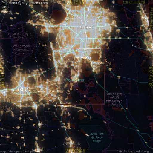
Analysis of Poinciana night lights 2016
Square area 10x10 km:
 2.65%
2.65%90-99
7.95%80-89
3.79%70-79
9.85%60-69
28.22%50-59
7.39%40-49
7.58%30-39
5.3%20-29
10.98%10-19
13.83%0-9
2.46%Square area 50x50 km:
5.38%90-99
6.23%80-89
3.38%70-79
4.01%60-69
12.34%50-59
6.91%40-49
6.39%30-39
6.1%20-29
8.32%10-19
10.59%0-9
30.34%Clear (daylight) street map image can be seen on geolist.org.
Map coordinates:
28° 45' 30.6" North, 82° 9' 41.5" West
28° 8' 25" North, 81° 27' 30.3" West
27° 31' 6.6" North, 80° 45' 19" West
Some cities around Poinciana sort by population:
• Kissimmee
18.7 km =11.6 mi,  12°
12°
• Saint Cloud
21.2 km =13.2 mi,  55°
55°
• Buenaventura Lakes
24.1 km =15 mi,  25°
25°
• Haines City
16.1 km =10 mi,  259°
259°
• Hunters Creek
24.7 km =15.3 mi, 8°
• Cypress Gardens
28 km =17.4 mi,  234°
234°
• Celebration
21.8 km =13.5 mi,  340°
340°
• Lake Alfred
26.5 km =16.5 mi, 258°
4168930 (p: 53,193)
Sources (retrieved 2019-11-25):
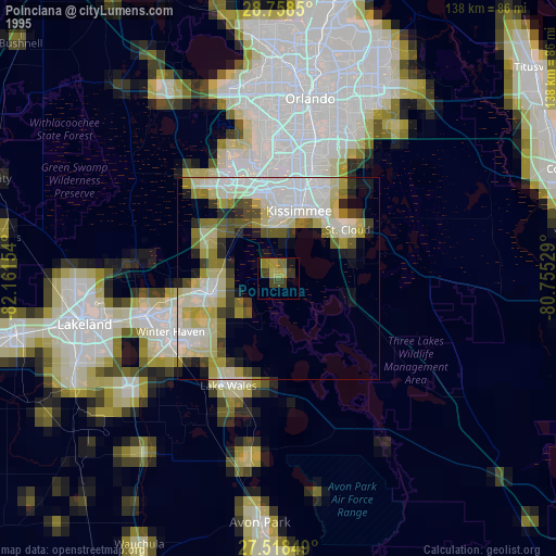
» NASA, Earths city lights 1995
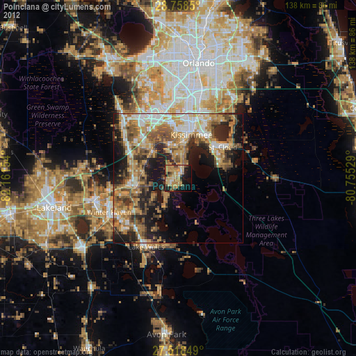
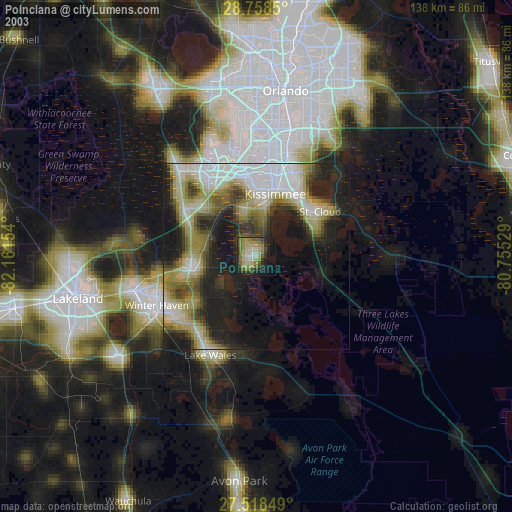
» NASA city lights 2003
» Earth at Night: Flat Maps 2012, 2016