Haines City night lights from space
Night Light of Haines City (Florida) from space (United States) Src. Average luminocity for 10x10km area is 56.5795% and for 50x50km: 40.1195%.
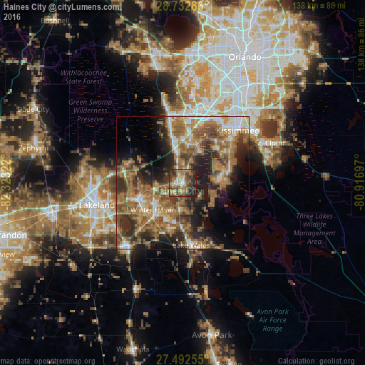
Analysis of Haines City night lights 2016
Square area 10x10 km:
 4.55%
4.55%90-99
7.95%80-89
7.58%70-79
2.65%60-69
24.81%50-59
9.28%40-49
17.61%30-39
12.88%20-29
10.23%10-19
2.46%0-9
0%Square area 50x50 km:
4.13%90-99
5.18%80-89
3.01%70-79
4.52%60-69
15.48%50-59
8.69%40-49
7.7%30-39
6.82%20-29
9.73%10-19
11.54%0-9
23.19%Clear (daylight) street map image can be seen on geolist.org.
Map coordinates:
28° 43' 58.3" North, 82° 19' 23.6" West
28° 6' 52.2" North, 81° 37' 12.3" West
27° 29' 33.2" North, 80° 55' 1.1" West
Some cities around Haines City sort by population:
• Poinciana
16.1 km =10 mi,  79°
79°
• Winter Haven
15.1 km =9.4 mi,  227°
227°
• Auburndale
17.4 km =10.8 mi,  251°
251°
• Cypress Gardens
15.1 km =9.4 mi,  207°
207°
• Inwood
16.6 km =10.3 mi,  238°
238°
• Jan-Phyl Village
18.6 km =11.6 mi, 233°
• Lake Alfred
10.4 km =6.5 mi,  256°
256°
• Wahneta
20.8 km =12.9 mi, 210°
4157827 (p: 22,807)
Sources (retrieved 2019-11-25):
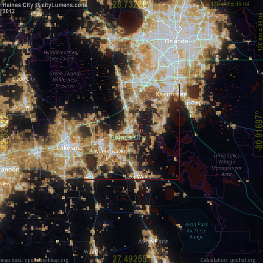
» Earth at Night: Flat Maps 2012, 2016