Kissimmee night lights from space
Night Light of Kissimmee (Florida) from space (United States) Src. Average luminocity for 10x10km area is 84.881% and for 50x50km: 59.5093%.
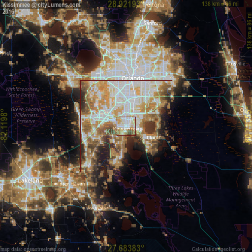
Analysis of Kissimmee night lights 2016
Square area 10x10 km:
 23.41%
90-99
28.77%80-89
14.48%70-79
11.9%60-69
11.51%50-59
5.36%40-49
2.98%30-39
1.59%20-29
0%10-19
0%0-9
0%Square area 50x50 km:
14.99%90-99
14%80-89
6.63%70-79
8.53%60-69
12.59%50-59
6.86%40-49
5.75%30-39
5.03%20-29
6.02%10-19
7.11%0-9
12.49%Clear (daylight) street map image can be seen on geolist.org.
Map coordinates:
28° 55' 18.9" North, 82° 7' 11.3" West
28° 18' 16.8" North, 81° 25' 0" West
27° 41' 1.8" North, 80° 42' 48.8" West
Some cities around Kissimmee sort by population:
• Saint Cloud
14.6 km =9.1 mi,  115°
115°
• Buenaventura Lakes
7.1 km =4.4 mi,  60°
60°
• Meadow Woods
10.2 km =6.3 mi,  28°
28°
• Southchase
10.4 km =6.5 mi,  18°
18°
• Hunters Creek
6.2 km =3.9 mi,  354°
354°
• Williamsburg
12.5 km =7.8 mi, 348°
• Celebration
11.6 km =7.2 mi,  281°
281°
• Sky Lake
17.1 km =10.6 mi,  8°
8°
4160983 (p: 69,152)
Sources (retrieved 2019-11-25):
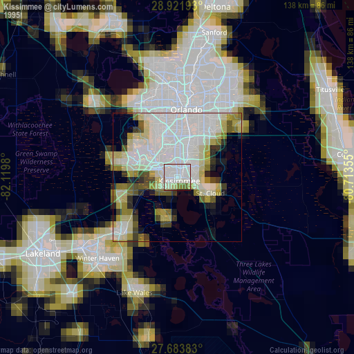
» NASA, Earths city lights 1995
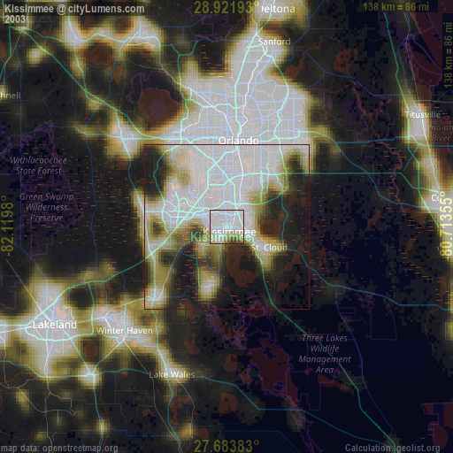
» NASA city lights 2003
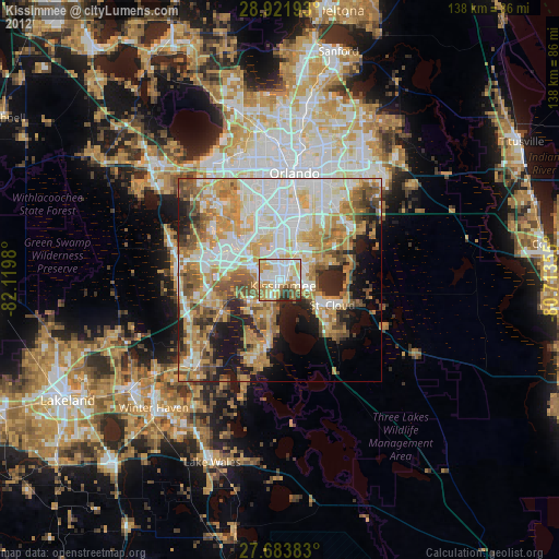
» Earth at Night: Flat Maps 2012, 2016