Pinewood night lights from space
Night Light of Pinewood (Florida) from space (United States) Src. Average luminocity for 10x10km area is 99.0246% and for 50x50km: 61.339%.
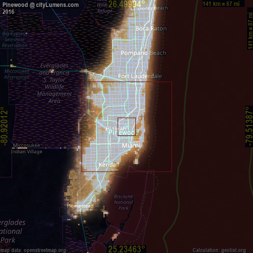
Analysis of Pinewood night lights 2016
Square area 10x10 km:
 85.61%
90-99
10.98%80-89
0.57%70-79
2.84%60-69
0%50-59
0%40-49
0%30-39
0%20-29
0%10-19
0%0-9
0%Square area 50x50 km:
34.57%90-99
12.44%80-89
2.69%70-79
3.7%60-69
5.07%50-59
3.32%40-49
3.91%30-39
3.62%20-29
2.84%10-19
4.22%0-9
23.63%Clear (daylight) street map image can be seen on geolist.org.
Map coordinates:
26° 29' 59.8" North, 80° 55' 12.4" West
25° 52' 8.3" North, 80° 13' 1.2" West
25° 14' 4.7" North, 79° 30' 49.9" West
Some cities around Pinewood sort by population:
• North Miami
3.8 km =2.4 mi,  52°
52°
• West Little River
2.4 km =1.5 mi,  236°
236°
• Golden Glades
5 km =3.1 mi,  19°
19°
• Opa-locka
5 km =3.1 mi,  318°
318°
• Brownsville
5.8 km =3.6 mi,  204°
204°
• Gladeview
3.8 km =2.4 mi,  209°
209°
• Miami Shores
2.5 km =1.6 mi,  105°
105°
• Westview
2.9 km =1.8 mi,  300°
300°
4168659 (p: 16,520)
Sources (retrieved 2019-11-25):
» Earth at Night: Flat Maps 2012, 2016