Perry night lights from space
Night Light of Perry (Florida) from space (United States) Src. Average luminocity for 10x10km area is 24.8504% and for 50x50km: 1.353%.
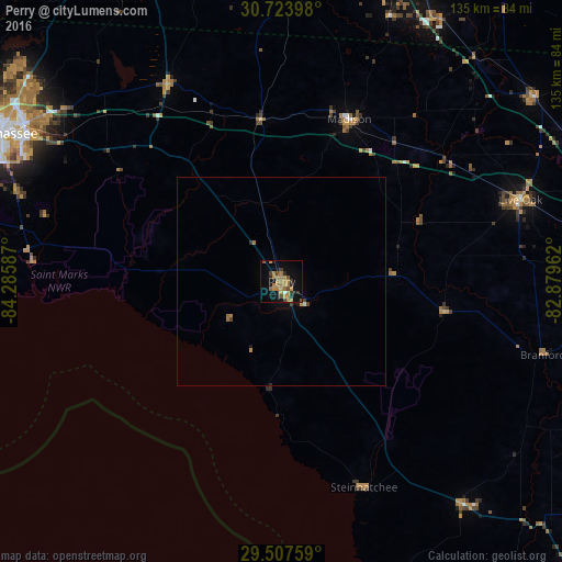
Analysis of Perry night lights 2016
Square area 10x10 km:
 0.57%
0.57%90-99
0.19%80-89
0.95%70-79
8.9%60-69
10.42%50-59
3.22%40-49
3.41%30-39
2.46%20-29
4.92%10-19
17.8%0-9
47.16%Square area 50x50 km:
0.04%90-99
0.02%80-89
0.04%70-79
0.42%60-69
0.52%50-59
0.14%40-49
0.22%30-39
0.17%20-29
0.21%10-19
0.78%0-9
97.45%Clear (daylight) street map image can be seen on geolist.org.
Map coordinates:
30° 43' 26.3" North, 84° 17' 9.1" West
30° 7' 3.6" North, 83° 34' 57.9" West
29° 30' 27.3" North, 82° 52' 46.6" West
Some cities around Perry sort by population:
• Tallahassee
75.9 km =47.2 mi,  298°
298°
• Valdosta
84.7 km =52.6 mi,  20°
20°
• Thomasville
88.5 km =55 mi,  334°
334°
• Lake City
91.1 km =56.6 mi,  84°
84°
• Cairo
103.2 km =64.1 mi,  324°
324°
• Live Oak
60.8 km =37.8 mi,  71°
71°
• High Springs
100.3 km =62.3 mi,  108°
108°
• Newberry
107.7 km =66.9 mi,  119°
119°
4168244 (p: 7,055)
Sources (retrieved 2019-11-25):
» Earth at Night: Flat Maps 2012, 2016