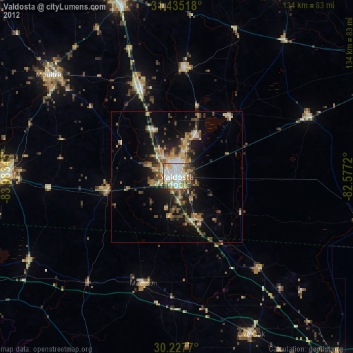
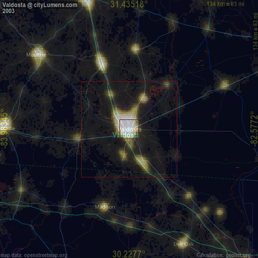
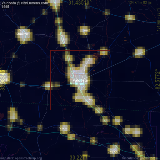
Valdosta night lights from space
Night Light of Valdosta (Georgia) from space (United States) Src. Average luminocity for 10x10km area is 76.785% and for 50x50km: 12.3452%.
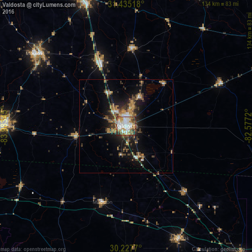
Analysis of Valdosta night lights 2016
Square area 10x10 km:
 24.48%
90-99
21.68%80-89
4.9%70-79
11.36%60-69
14.34%50-59
5.07%40-49
9.09%30-39
3.85%20-29
5.07%10-19
0.17%0-9
0%Square area 50x50 km:
1.54%90-99
1.53%80-89
0.44%70-79
2.48%60-69
2.56%50-59
1.23%40-49
2.26%30-39
2.81%20-29
3.03%10-19
7.94%0-9
74.18%Clear (daylight) street map image can be seen on geolist.org.
Map coordinates:
31° 26' 6.6" North, 83° 59' 0.4" West
30° 50' 0" North, 83° 16' 49.2" West
30° 13' 39.7" North, 82° 34' 37.9" West
Some cities around Valdosta sort by population:
• Thomasville
66.7 km =41.4 mi,  270°
270°
• Tifton
72 km =44.7 mi,  342°
342°
• Moultrie
61.9 km =38.5 mi,  308°
308°
• Douglas
85.5 km =53.1 mi,  28°
28°
• Cairo
88.1 km =54.7 mi, 273°
• Perry
84.7 km =52.6 mi,  200°
200°
• Live Oak
66.2 km =41.1 mi,  154°
154°
• Adel
36.5 km =22.7 mi, 337°
4228147 (p: 55,724)
Sources (retrieved 2019-11-25):
» NASA, Earths city lights 1995
» NASA city lights 2003
» Earth at Night: Flat Maps 2012, 2016