Newberry night lights from space
Night Light of Newberry (Florida) from space (United States) Src. Average luminocity for 10x10km area is 12.2659% and for 50x50km: 10.2116%.
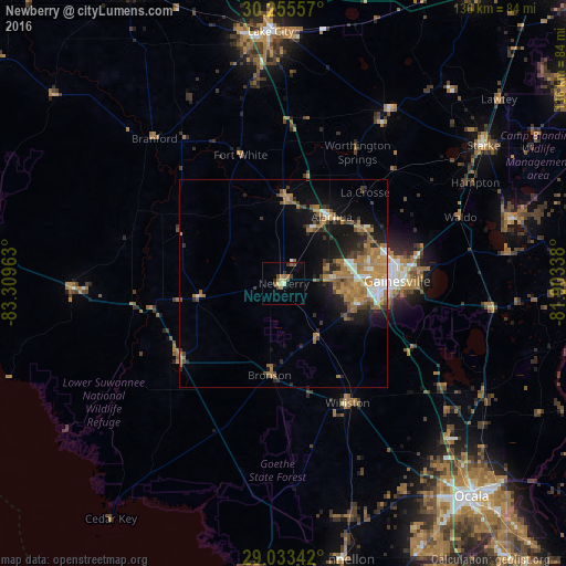
Analysis of Newberry night lights 2016
Square area 10x10 km:
 0%
0%90-99
1.59%80-89
1.98%70-79
1.79%60-69
2.58%50-59
1.59%40-49
3.37%30-39
1.98%20-29
0.99%10-19
0.2%0-9
83.93%Square area 50x50 km:
0.9%90-99
1.17%80-89
0.57%70-79
1.97%60-69
3.71%50-59
1.03%40-49
1.52%30-39
1.33%20-29
2.32%10-19
5.52%0-9
79.97%Clear (daylight) street map image can be seen on geolist.org.
Map coordinates:
30° 15' 20.1" North, 83° 18' 34.7" West
29° 38' 46.9" North, 82° 36' 23.4" West
29° 2' 0.3" North, 81° 54' 12.2" West
Some cities around Newberry sort by population:
• Gainesville
27.2 km =16.9 mi,  88°
88°
• Ocala
68.2 km =42.4 mi,  138°
138°
• Lake City
60.5 km =37.6 mi,  357°
357°
• Silver Springs
71.5 km =44.4 mi,  131°
131°
• Alachua
21.1 km =13.1 mi,  56°
56°
• High Springs
20.1 km =12.5 mi,  2°
2°
• Citra
54.7 km =34 mi,  118°
118°
• Starke
58.2 km =36.2 mi, 55°
4165961 (p: 5,564)
Sources (retrieved 2019-11-25):
» Earth at Night: Flat Maps 2012, 2016