Lake City night lights from space
Night Light of Lake City (Florida) from space (United States) Src. Average luminocity for 10x10km area is 50.0087% and for 50x50km: 5.5018%.
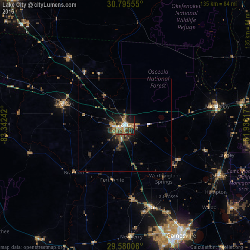
Analysis of Lake City night lights 2016
Square area 10x10 km:
 5.42%
5.42%90-99
6.82%80-89
4.72%70-79
12.06%60-69
14.51%50-59
3.67%40-49
7.87%30-39
11.36%20-29
14.86%10-19
17.83%0-9
0.87%Square area 50x50 km:
0.35%90-99
0.42%80-89
0.22%70-79
0.98%60-69
1.36%50-59
0.71%40-49
1.1%30-39
1.71%20-29
1.78%10-19
3.58%0-9
87.79%Clear (daylight) street map image can be seen on geolist.org.
Map coordinates:
30° 47' 44" North, 83° 20' 32.7" West
30° 11' 22.8" North, 82° 38' 21.4" West
29° 34' 48.2" North, 81° 56' 10.2" West
Some cities around Lake City sort by population:
• Gainesville
67.1 km =41.7 mi,  153°
153°
• Middleburg
76.1 km =47.3 mi,  100°
100°
• Alachua
52.9 km =32.9 mi,  157°
157°
• Live Oak
35.1 km =21.8 mi,  289°
289°
• Macclenny
50.7 km =31.5 mi,  78°
78°
• High Springs
40.5 km =25.2 mi,  174°
174°
• Newberry
60.5 km =37.6 mi,  177°
177°
• Starke
57.8 km =35.9 mi,  118°
118°
4161187 (p: 12,161)
Sources (retrieved 2019-11-25):
» Earth at Night: Flat Maps 2012, 2016