Perry night lights from space
Night Light of Perry (Georgia) from space (United States) Src. Average luminocity for 10x10km area is 49.489% and for 50x50km: 16.9836%.
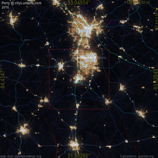
Analysis of Perry night lights 2016
Square area 10x10 km:
 8.79%
8.79%90-99
8.61%80-89
2.56%70-79
9.34%60-69
9.34%50-59
8.06%40-49
9.89%30-39
4.95%20-29
11.54%10-19
24.91%0-9
2.01%Square area 50x50 km:
2.44%90-99
2.64%80-89
1.83%70-79
3.21%60-69
3.44%50-59
1.81%40-49
2.18%30-39
2.97%20-29
3.4%10-19
7.53%0-9
68.55%Clear (daylight) street map image can be seen on geolist.org.
Map coordinates:
33° 2' 58.3" North, 84° 26' 4.9" West
32° 27' 29.6" North, 83° 43' 53.7" West
31° 51' 46.7" North, 83° 1' 42.4" West
Some cities around Perry sort by population:
• Macon
43.5 km =27 mi,  12°
12°
• Warner Robins
20.1 km =12.5 mi,  29°
29°
• Cordele
55.2 km =34.3 mi,  184°
184°
• Fort Valley
18.1 km =11.2 mi,  306°
306°
• Centerville
19.5 km =12.1 mi, 11°
• Hawkinsville
31.1 km =19.3 mi,  128°
128°
• Eastman
59.6 km =37 mi,  119°
119°
• Byron
21.9 km =13.6 mi,  353°
353°
4215391 (p: 15,457)
Sources (retrieved 2019-11-25):
» Earth at Night: Flat Maps 2012, 2016