Hawkinsville night lights from space
Night Light of Hawkinsville (Georgia) from space (United States) Src. Average luminocity for 10x10km area is 17.0275% and for 50x50km: 4.1669%.
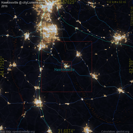
Analysis of Hawkinsville night lights 2016
Square area 10x10 km:
 1.1%
1.1%90-99
1.1%80-89
1.65%70-79
3.11%60-69
4.58%50-59
0.37%40-49
3.48%30-39
5.49%20-29
2.93%10-19
4.58%0-9
71.61%Square area 50x50 km:
0.27%90-99
0.34%80-89
0.31%70-79
0.78%60-69
0.76%50-59
0.42%40-49
0.83%30-39
1.07%20-29
1.05%10-19
2.42%0-9
91.76%Clear (daylight) street map image can be seen on geolist.org.
Map coordinates:
32° 52' 34.5" North, 84° 10' 30.9" West
32° 17' 1.6" North, 83° 28' 19.6" West
31° 41' 14.6" North, 82° 46' 8.4" West
Some cities around Hawkinsville sort by population:
• Warner Robins
39.7 km =24.7 mi,  338°
338°
• Perry
31.1 km =19.3 mi,  308°
308°
• Cordele
46.1 km =28.6 mi,  219°
219°
• Fort Valley
49.2 km =30.6 mi, 307°
• Centerville
43.6 km =27.1 mi,  332°
332°
• McRae
58.9 km =36.6 mi,  114°
114°
• Eastman
29.3 km =18.2 mi, 109°
• Byron
49.2 km =30.6 mi, 326°
4199694 (p: 5,471)
Sources (retrieved 2019-11-25):
» Earth at Night: Flat Maps 2012, 2016