Pauls Valley night lights from space
Night Light of Pauls Valley (Oklahoma) from space (United States) Src. Average luminocity for 10x10km area is 23.1465% and for 50x50km: 2.57%.
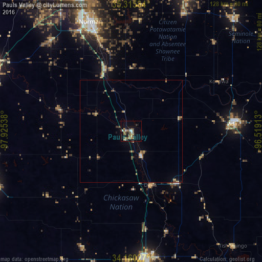
Analysis of Pauls Valley night lights 2016
Square area 10x10 km:
 2.75%
2.75%90-99
1.65%80-89
2.01%70-79
2.75%60-69
4.21%50-59
7.14%40-49
2.56%30-39
5.13%20-29
3.66%10-19
15.02%0-9
53.11%Square area 50x50 km:
0.16%90-99
0.1%80-89
0.39%70-79
0.3%60-69
0.47%50-59
0.64%40-49
0.29%30-39
0.58%20-29
0.23%10-19
0.92%0-9
95.91%Clear (daylight) street map image can be seen on geolist.org.
Map coordinates:
35° 18' 57" North, 97° 55' 31.4" West
34° 44' 24.3" North, 97° 13' 20.1" West
34° 9' 37" North, 96° 31' 8.9" West
Some cities around Pauls Valley sort by population:
• Norman
57.2 km =35.5 mi,  339°
339°
• Ada
49.8 km =30.9 mi,  85°
85°
• Blanchard
59.4 km =36.9 mi,  318°
318°
• Noble
47.1 km =29.3 mi, 340°
• Tecumseh
63.2 km =39.3 mi,  24°
24°
• Purcell
33 km =20.5 mi, 337°
• Lone Grove
62.9 km =39.1 mi,  183°
183°
• Sulphur
34.7 km =21.6 mi,  138°
138°
4547690 (p: 6,152)
Sources (retrieved 2019-11-25):
» Earth at Night: Flat Maps 2012, 2016