Noble night lights from space
Night Light of Noble (Oklahoma) from space (United States) Src. Average luminocity for 10x10km area is 35.3322% and for 50x50km: 20.7053%.
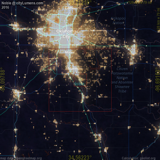
Analysis of Noble night lights 2016
Square area 10x10 km:
 2.1%
2.1%90-99
2.1%80-89
7.69%70-79
5.07%60-69
4.37%50-59
3.32%40-49
7.87%30-39
8.04%20-29
20.28%10-19
35.31%0-9
3.85%Square area 50x50 km:
2.2%90-99
2.46%80-89
2.59%70-79
2.08%60-69
3.04%50-59
3.45%40-49
4.31%30-39
6.11%20-29
7.63%10-19
10.49%0-9
55.64%Clear (daylight) street map image can be seen on geolist.org.
Map coordinates:
35° 42' 43.9" North, 98° 5' 52.4" West
35° 8' 21.3" North, 97° 23' 41.1" West
34° 33' 44" North, 96° 41' 29.9" West
Some cities around Noble sort by population:
• Oklahoma City
38.1 km =23.7 mi,  343°
343°
• Norman
10.1 km =6.3 mi, 336°
• Moore
23.8 km =14.8 mi, 339°
• Midwest City
34.5 km =21.4 mi,  359°
359°
• Del City
33.9 km =21.1 mi,  352°
352°
• Newcastle
22.2 km =13.8 mi,  302°
302°
• Blanchard
23.9 km =14.9 mi,  269°
269°
• Purcell
14.3 km =8.9 mi,  167°
167°
4543733 (p: 6,666)
Sources (retrieved 2019-11-25):
» Earth at Night: Flat Maps 2012, 2016