Tecumseh night lights from space
Night Light of Tecumseh (Oklahoma) from space (United States) Src. Average luminocity for 10x10km area is 22.4441% and for 50x50km: 10.2082%.
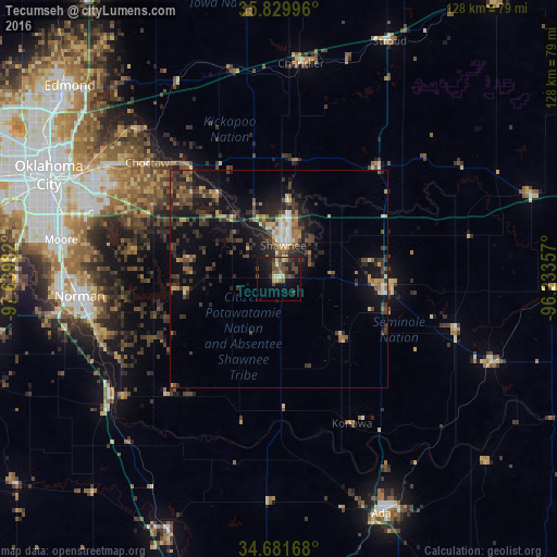
Analysis of Tecumseh night lights 2016
Square area 10x10 km:
 0.17%
0.17%90-99
2.27%80-89
2.27%70-79
3.15%60-69
2.1%50-59
6.29%40-49
7.52%30-39
4.2%20-29
6.29%10-19
18.88%0-9
46.85%Square area 50x50 km:
0.58%90-99
0.73%80-89
1.07%70-79
1.19%60-69
1.49%50-59
1.51%40-49
2.36%30-39
3.47%20-29
3.86%10-19
8.37%0-9
75.39%Clear (daylight) street map image can be seen on geolist.org.
Map coordinates:
35° 49' 47.9" North, 97° 38' 23.4" West
35° 15' 28.3" North, 96° 56' 12.1" West
34° 40' 54" North, 96° 14' 0.9" West
Some cities around Tecumseh sort by population:
• Norman
45.8 km =28.5 mi,  265°
265°
• Midwest City
46.8 km =29.1 mi,  297°
297°
• Shawnee
7.8 km =4.8 mi,  7°
7°
• Choctaw
40.2 km =25 mi,  311°
311°
• Seminole
24.4 km =15.2 mi,  98°
98°
• Noble
43.7 km =27.2 mi,  252°
252°
• Purcell
47.2 km =29.3 mi,  234°
234°
• Harrah
33 km =20.5 mi,  321°
321°
4552820 (p: 6,630)
Sources (retrieved 2019-11-25):
» Earth at Night: Flat Maps 2012, 2016