Paola night lights from space
Night Light of Paola (Kansas) from space (United States) Src. Average luminocity for 10x10km area is 10.8929% and for 50x50km: 3.3888%.
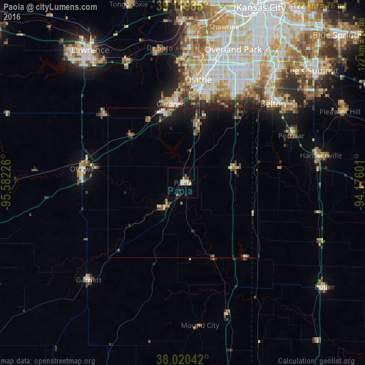
Analysis of Paola night lights 2016
Square area 10x10 km:
 0.97%
0.97%90-99
1.3%80-89
1.62%70-79
1.79%60-69
1.14%50-59
1.62%40-49
1.95%30-39
1.62%20-29
0.65%10-19
0.32%0-9
87.01%Square area 50x50 km:
0.2%90-99
0.32%80-89
0.42%70-79
0.36%60-69
0.36%50-59
0.59%40-49
0.75%30-39
0.45%20-29
0.79%10-19
3.21%0-9
92.55%Clear (daylight) street map image can be seen on geolist.org.
Map coordinates:
39° 7' 11.5" North, 95° 34' 56.1" West
38° 34' 20.1" North, 94° 52' 44.9" West
38° 1' 13.5" North, 94° 10' 33.6" West
Some cities around Paola sort by population:
• Olathe
34.8 km =21.6 mi,  8°
8°
• Lenexa
44.2 km =27.5 mi,  16°
16°
• Belton
40.2 km =25 mi,  48°
48°
• Gardner
26.9 km =16.7 mi,  351°
351°
• Raymore
45 km =28 mi,  55°
55°
• Ottawa
34.1 km =21.2 mi,  278°
278°
• Eudora
45.4 km =28.2 mi,  335°
335°
• Spring Hill
19.6 km =12.2 mi, 13°
4276956 (p: 5,527)
Sources (retrieved 2019-11-25):
» Earth at Night: Flat Maps 2012, 2016