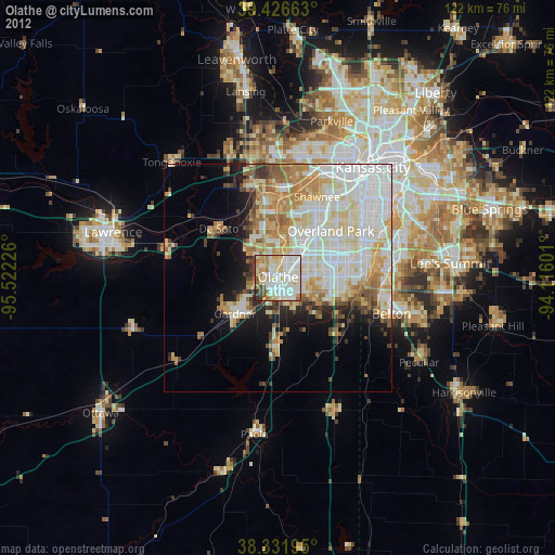
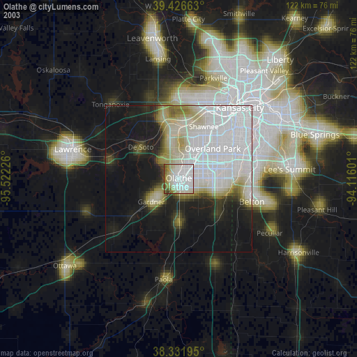
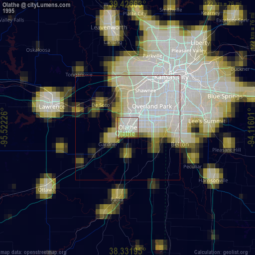
Olathe night lights from space
Night Light of Olathe (Kansas) from space (United States) Src. Average luminocity for 10x10km area is 84.6446% and for 50x50km: 39.0458%.

Analysis of Olathe night lights 2016
Square area 10x10 km:
 23.3%
23.3%90-99
31.97%80-89
13.78%70-79
10.03%60-69
8.33%50-59
5.61%40-49
3.74%30-39
3.23%20-29
0%10-19
0%0-9
0%Square area 50x50 km:
11.24%90-99
10.45%80-89
5.84%70-79
4.41%60-69
4.37%50-59
3.4%40-49
2.81%30-39
2.73%20-29
3.96%10-19
6.89%0-9
43.91%Clear (daylight) street map image can be seen on geolist.org.
Map coordinates:
39° 25' 35.9" North, 95° 31' 20.1" West
38° 52' 53" North, 94° 49' 8.9" West
38° 19' 55" North, 94° 6' 57.6" West
Some cities around Olathe sort by population:
• Overland Park
17 km =10.6 mi,  48°
48°
• Shawnee
19.8 km =12.3 mi,  25°
25°
• Lenexa
10.9 km =6.8 mi,  42°
42°
• Leawood
19.9 km =12.4 mi,  61°
61°
• Gardner
12.2 km =7.6 mi,  230°
230°
• Merriam
19.2 km =11.9 mi, 34°
• De Soto
16.9 km =10.5 mi,  310°
310°
• Spring Hill
15.4 km =9.6 mi,  182°
182°
4276614 (p: 134,305)
Sources (retrieved 2019-11-25):
» NASA, Earths city lights 1995
» NASA city lights 2003
» Earth at Night: Flat Maps 2012, 2016