Palmerton night lights from space
Night Light of Palmerton (Pennsylvania) from space (United States) Src. Average luminocity for 10x10km area is 15.6735% and for 50x50km: 15.6918%.
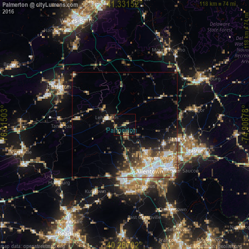
Analysis of Palmerton night lights 2016
Square area 10x10 km:
 0%
0%90-99
0.51%80-89
1.87%70-79
2.21%60-69
2.55%50-59
4.42%40-49
2.89%30-39
3.4%20-29
1.87%10-19
13.1%0-9
67.18%Square area 50x50 km:
2.53%90-99
2.88%80-89
1.95%70-79
1.94%60-69
2.49%50-59
2.11%40-49
2.15%30-39
2.97%20-29
3.09%10-19
5.46%0-9
72.42%Clear (daylight) street map image can be seen on geolist.org.
Map coordinates:
41° 19' 53.5" North, 76° 18' 54.1" West
40° 48' 5" North, 75° 36' 42.8" West
40° 16' 1.3" North, 74° 54' 31.6" West
Some cities around Palmerton sort by population:
• Allentown
23.8 km =14.8 mi,  154°
154°
• Whitehall Township
17.7 km =11 mi, 147°
• Fullerton
22.2 km =13.8 mi, 148°
• Northampton
16.1 km =10 mi,  142°
142°
• Catasauqua
20 km =12.4 mi, 144°
• Wescosville
26.6 km =16.5 mi,  169°
169°
• Nazareth
26.3 km =16.3 mi,  104°
104°
• Lehighton
9.3 km =5.8 mi,  292°
292°
5204957 (p: 5,305)
Sources (retrieved 2019-11-25):
» Earth at Night: Flat Maps 2012, 2016