Palatine night lights from space
Night Light of Palatine (Illinois) from space (United States) Src. Average luminocity for 10x10km area is 87.9803% and for 50x50km: 74.0694%.
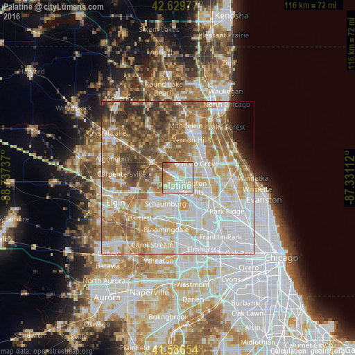
Analysis of Palatine night lights 2016
Square area 10x10 km:
 27.27%
90-99
31.82%80-89
14.7%70-79
11.52%60-69
9.39%50-59
4.39%40-49
0.91%30-39
0%20-29
0%10-19
0%0-9
0%Square area 50x50 km:
22.3%90-99
17.28%80-89
10.88%70-79
9.27%60-69
12.43%50-59
10.59%40-49
6.44%30-39
3.3%20-29
3.22%10-19
1.41%0-9
2.89%Clear (daylight) street map image can be seen on geolist.org.
Map coordinates:
42° 37' 47.2" North, 88° 44' 14.5" West
42° 6' 37.1" North, 88° 2' 3.3" West
41° 35' 11.5" North, 87° 19' 52" West
Some cities around Palatine sort by population:
• Arlington Heights
5.1 km =3.2 mi,  118°
118°
• Hoffman Estates
8.4 km =5.2 mi,  206°
206°
• Buffalo Grove
7.7 km =4.8 mi,  53°
53°
• Wheeling
9.3 km =5.8 mi,  69°
69°
• Rolling Meadows
3.4 km =2.1 mi,  149°
149°
• Prospect Heights
8.1 km =5 mi,  101°
101°
• Long Grove
8.1 km =5 mi,  21°
21°
• Inverness
5.2 km =3.2 mi,  279°
279°
4905211 (p: 69,308)
Sources (retrieved 2019-11-25):
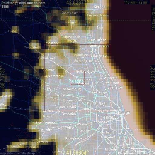
» NASA, Earths city lights 1995
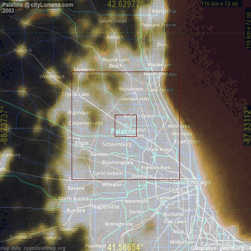
» NASA city lights 2003
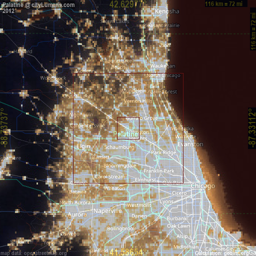
» Earth at Night: Flat Maps 2012, 2016