Painesville night lights from space
Night Light of Painesville (Ohio) from space (United States) Src. Average luminocity for 10x10km area is 62.6851% and for 50x50km: 19.2461%.
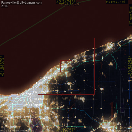
Analysis of Painesville night lights 2016
Square area 10x10 km:
 12.01%
90-99
14.29%80-89
7.14%70-79
9.25%60-69
8.93%50-59
12.99%40-49
10.39%30-39
6.66%20-29
13.96%10-19
4.38%0-9
0%Square area 50x50 km:
3.74%90-99
4.5%80-89
2.12%70-79
1.81%60-69
2.19%50-59
2.28%40-49
2.44%30-39
2.73%20-29
4.96%10-19
9.1%0-9
64.13%Clear (daylight) street map image can be seen on geolist.org.
Map coordinates:
42° 14' 49.7" North, 81° 56' 55.6" West
41° 43' 28.2" North, 81° 14' 44.4" West
41° 11' 51.3" North, 80° 32' 33.1" West
Some cities around Painesville sort by population:
• Mentor
10.1 km =6.3 mi,  230°
230°
• Willoughby
16.3 km =10.1 mi, 234°
• Eastlake
18.7 km =11.6 mi,  245°
245°
• Willoughby Hills
20.1 km =12.5 mi, 225°
• North Madison
18.4 km =11.4 mi,  62°
62°
• Mentor-on-the-Lake
9.8 km =6.1 mi,  257°
257°
• Kirtland
14.3 km =8.9 mi,  222°
222°
• Chardon
14.7 km =9.1 mi,  146°
146°
5166009 (p: 19,776)
Sources (retrieved 2019-11-25):
» Earth at Night: Flat Maps 2012, 2016