Ossining night lights from space
Night Light of Ossining (New York) from space (United States) Src. Average luminocity for 10x10km area is 42.0276% and for 50x50km: 42.4738%.
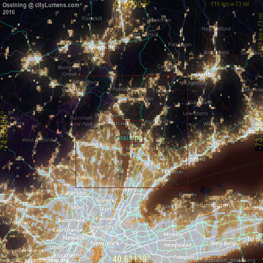
Analysis of Ossining night lights 2016
Square area 10x10 km:
 1.14%
1.14%90-99
2.11%80-89
10.06%70-79
5.03%60-69
5.03%50-59
9.09%40-49
13.31%30-39
6.82%20-29
32.47%10-19
14.94%0-9
0%Square area 50x50 km:
4.89%90-99
6.21%80-89
5.75%70-79
7.77%60-69
11.76%50-59
7.23%40-49
5.52%30-39
5.72%20-29
8.48%10-19
15.48%0-9
21.18%Clear (daylight) street map image can be seen on geolist.org.
Map coordinates:
41° 41' 24.3" North, 74° 33' 52.7" West
41° 9' 46.3" North, 73° 51' 41.5" West
40° 37' 53" North, 73° 9' 30.2" West
Some cities around Ossining sort by population:
• Haverstraw
9.4 km =5.8 mi,  294°
294°
• Sleepy Hollow
8.6 km =5.3 mi,  178°
178°
• Valley Cottage
9.3 km =5.8 mi,  237°
237°
• Congers
7.2 km =4.5 mi,  259°
259°
• Croton-on-Hudson
5.6 km =3.5 mi,  333°
333°
• Briarcliff Manor
3.7 km =2.3 mi,  121°
121°
• Pleasantville
6.7 km =4.2 mi, 120°
• Nyack
9.3 km =5.8 mi,  210°
210°
5130045 (p: 25,441)
Sources (retrieved 2019-11-25):
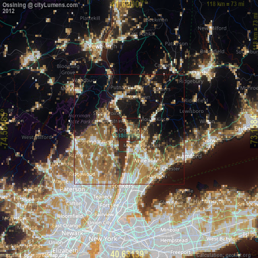
» Earth at Night: Flat Maps 2012, 2016