Nyack night lights from space
Night Light of Nyack (New York) from space (United States) Src. Average luminocity for 10x10km area is 57.4886% and for 50x50km: 53.3448%.
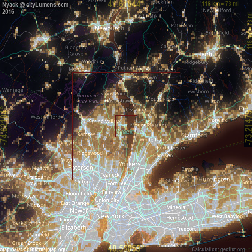
Analysis of Nyack night lights 2016
Square area 10x10 km:
 5.52%
5.52%90-99
7.31%80-89
11.69%70-79
10.71%60-69
9.74%50-59
10.55%40-49
12.66%30-39
14.45%20-29
17.37%10-19
0%0-9
0%Square area 50x50 km:
11.4%90-99
10.1%80-89
6.44%70-79
8.73%60-69
12.48%50-59
7.21%40-49
4.9%30-39
5.21%20-29
8.6%10-19
12.74%0-9
12.2%Clear (daylight) street map image can be seen on geolist.org.
Map coordinates:
41° 37' 6.4" North, 74° 37' 15.7" West
41° 5' 26.3" North, 73° 55' 4.5" West
40° 33' 30.9" North, 73° 12' 53.2" West
Some cities around Nyack sort by population:
• Nanuet
8 km =5 mi,  268°
268°
• Tarrytown
5.2 km =3.2 mi,  107°
107°
• Sleepy Hollow
5 km =3.1 mi,  96°
96°
• Valley Cottage
4.4 km =2.7 mi,  314°
314°
• Congers
7.1 km =4.4 mi,  340°
340°
• Tappan
8 km =5 mi,  197°
197°
• Irvington
7.1 km =4.4 mi,  143°
143°
• Blauvelt
4.5 km =2.8 mi,  227°
227°
5129433 (p: 7,004)
Sources (retrieved 2019-11-25):
» Earth at Night: Flat Maps 2012, 2016