Orlando night lights from space
Night Light of Orlando (Florida) from space (United States) Src. Average luminocity for 10x10km area is 98.8409% and for 50x50km: 74.6285%.

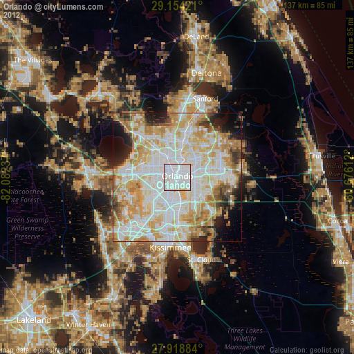
Analysis of Orlando night lights 2016
Square area 10x10 km:
 63.26%
90-99
34.66%80-89
2.08%70-79
0%60-69
0%50-59
0%40-49
0%30-39
0%20-29
0%10-19
0%0-9
0%Square area 50x50 km:
23.88%90-99
22.69%80-89
9.74%70-79
11.13%60-69
9.25%50-59
3.65%40-49
2.85%30-39
3.22%20-29
4%10-19
4.55%0-9
5.03%Clear (daylight) street map image can be seen on geolist.org.
Map coordinates:
29° 9' 15.2" North, 82° 4' 56.5" West
28° 32' 18" North, 81° 22' 45.3" West
27° 55' 7.8" North, 80° 40' 34" West
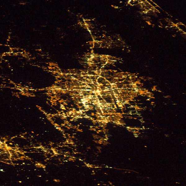
Fantastic image of Orlando from space taken by astronauts [src2], but I don't have information about it's orientation, scale or angle. If necessary, it was rotated manually, so North points approximately to upper direction. Click to zoom in:
Some cities around Orlando sort by population:
• Pine Hills
7.6 km =4.7 mi,  286°
286°
• Winter Park
7.9 km =4.9 mi,  29°
29°
• Oak Ridge
8.7 km =5.4 mi,  210°
210°
• Conway
6.2 km =3.9 mi,  129°
129°
• Azalea Park
7.7 km =4.8 mi,  87°
87°
• Pine Castle
7.5 km =4.7 mi,  171°
171°
• Fairview Shores
6 km =3.7 mi,  345°
345°
• Orlovista
7.9 km =4.9 mi,  270°
270°
4167147 (p: 270,934)
Sources (retrieved 2019-11-25):
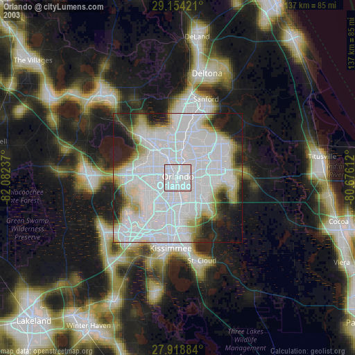
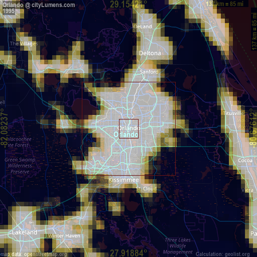
» NASA, Earths city lights 1995
» NASA city lights 2003
» Earth at Night: Flat Maps 2012, 2016
Src.2: Jeff Williams Twitter@Astro_Jeff 2016-04-15