Pine Hills night lights from space
Night Light of Pine Hills (Florida) from space (United States) Src. Average luminocity for 10x10km area is 97.2443% and for 50x50km: 73.3147%.
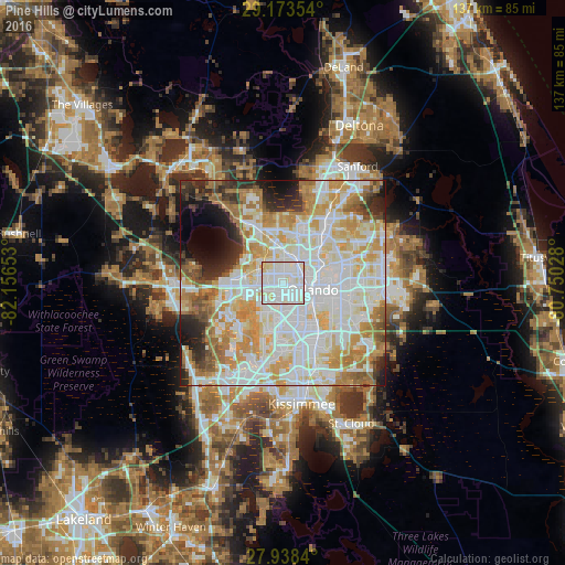

Analysis of Pine Hills night lights 2016
Square area 10x10 km:
 40.72%
90-99
50.38%80-89
8.9%70-79
0%60-69
0%50-59
0%40-49
0%30-39
0%20-29
0%10-19
0%0-9
0%Square area 50x50 km:
23.12%90-99
22.01%80-89
9.37%70-79
10.5%60-69
9.39%50-59
3.67%40-49
3.22%30-39
3.59%20-29
5.59%10-19
5.23%0-9
4.3%Clear (daylight) street map image can be seen on geolist.org.
Map coordinates:
29° 10' 24.7" North, 82° 9' 23.5" West
28° 33' 28" North, 81° 27' 12.2" West
27° 56' 18.2" North, 80° 45' 1" West
Some cities around Pine Hills sort by population:
• Orlando
7.6 km =4.7 mi,  106°
106°
• Ocoee
8.9 km =5.5 mi,  278°
278°
• Oak Ridge
10 km =6.2 mi,  163°
163°
• Maitland
11.8 km =7.3 mi,  48°
48°
• Lake Butler
10.6 km =6.6 mi,  233°
233°
• Lockhart
6.9 km =4.3 mi,  8°
8°
• Fairview Shores
6.9 km =4.3 mi,  57°
57°
• Orlovista
2.3 km =1.4 mi,  197°
197°
4168459 (p: 60,076)
Sources (retrieved 2019-11-25):
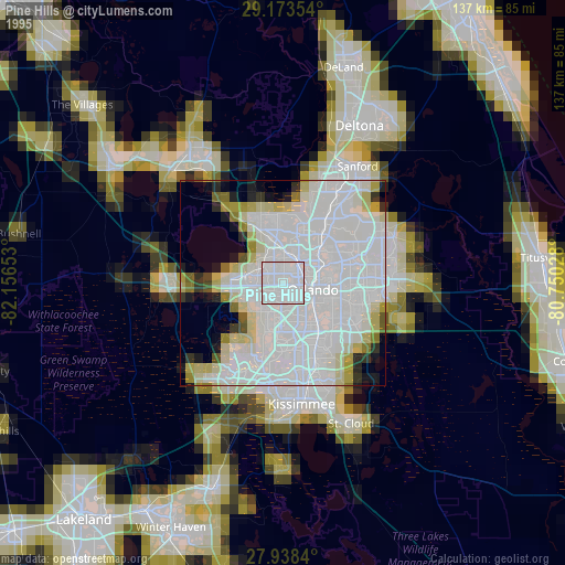
» NASA, Earths city lights 1995
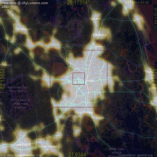
» NASA city lights 2003
» Earth at Night: Flat Maps 2012, 2016