Ojai night lights from space
Night Light of Ojai (California) from space (United States) Src. Average luminocity for 10x10km area is 11.4843% and for 50x50km: 8.5533%.
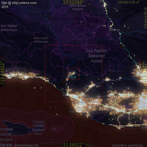
Analysis of Ojai night lights 2016
Square area 10x10 km:
 0%
0%90-99
0%80-89
0%70-79
1.05%60-69
4.02%50-59
3.5%40-49
5.07%30-39
3.85%20-29
1.4%10-19
1.92%0-9
79.2%Square area 50x50 km:
0.76%90-99
1.03%80-89
0.51%70-79
1.35%60-69
1.9%50-59
1.58%40-49
2.07%30-39
1.7%20-29
2.15%10-19
4.61%0-9
82.34%Clear (daylight) street map image can be seen on geolist.org.
Map coordinates:
35° 1' 33.1" North, 119° 56' 45.7" West
34° 26' 53" North, 119° 14' 34.4" West
33° 51' 58.4" North, 118° 32' 23.2" West
Some cities around Ojai sort by population:
• Oxnard
28.5 km =17.7 mi,  167°
167°
• Ventura
19.4 km =12.1 mi,  193°
193°
• Camarillo
31.9 km =19.8 mi,  143°
143°
• Santa Paula
19.8 km =12.3 mi,  121°
121°
• Fillmore
30.3 km =18.8 mi,  100°
100°
• Carpinteria
25.9 km =16.1 mi,  257°
257°
• El Rio
24.7 km =15.3 mi,  162°
162°
• Mira Monte
4.2 km =2.6 mi,  247°
247°
5378880 (p: 7,627)
Sources (retrieved 2019-11-25):
» Earth at Night: Flat Maps 2012, 2016