Oakdale night lights from space
Night Light of Oakdale (New York) from space (United States) Src. Average luminocity for 10x10km area is 60.3474% and for 50x50km: 38.9426%.
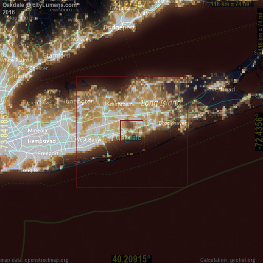
Analysis of Oakdale night lights 2016
Square area 10x10 km:
 10.55%
90-99
11.04%80-89
8.6%70-79
8.77%60-69
12.99%50-59
12.5%40-49
10.88%30-39
2.6%20-29
11.53%10-19
10.55%0-9
0%Square area 50x50 km:
6.7%90-99
7.84%80-89
5.82%70-79
8.42%60-69
7.51%50-59
5.87%40-49
3.75%30-39
2.88%20-29
5.75%10-19
6.96%0-9
38.5%Clear (daylight) street map image can be seen on geolist.org.
Map coordinates:
41° 16' 28.5" North, 73° 50' 30.7" West
40° 44' 38.4" North, 73° 8' 19.4" West
40° 12' 32.9" North, 72° 26' 8.2" West
Some cities around Oakdale sort by population:
• Central Islip
7.4 km =4.6 mi,  314°
314°
• Islip
6.2 km =3.9 mi,  255°
255°
• Sayville
4.9 km =3 mi,  100°
100°
• East Islip
4.2 km =2.6 mi,  251°
251°
• Bohemia
3.4 km =2.1 mi,  35°
35°
• Bayport
7.4 km =4.6 mi,  94°
94°
• Islip Terrace
4.5 km =2.8 mi,  268°
268°
• West Sayville
3.9 km =2.4 mi,  117°
117°
5129541 (p: 7,974)
Sources (retrieved 2019-11-25):
» Earth at Night: Flat Maps 2012, 2016