Bohemia night lights from space
Night Light of Bohemia (New York) from space (United States) Src. Average luminocity for 10x10km area is 73.9253% and for 50x50km: 37.8344%.
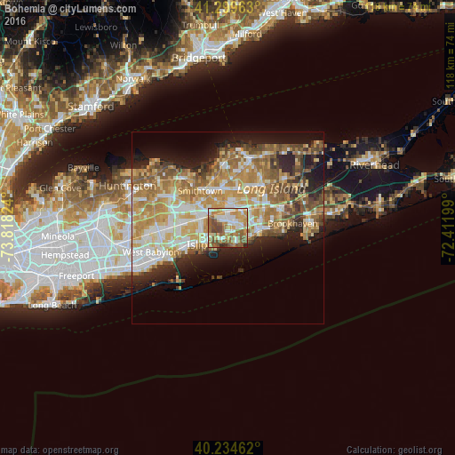
Analysis of Bohemia night lights 2016
Square area 10x10 km:
 15.42%
90-99
14.45%80-89
10.39%70-79
16.88%60-69
12.5%50-59
18.51%40-49
9.25%30-39
0.81%20-29
1.79%10-19
0%0-9
0%Square area 50x50 km:
5.82%90-99
7.17%80-89
5.74%70-79
8.25%60-69
7.46%50-59
6.06%40-49
3.98%30-39
2.95%20-29
5.84%10-19
9.25%0-9
37.49%Clear (daylight) street map image can be seen on geolist.org.
Map coordinates:
41° 17' 58.7" North, 73° 49' 5.7" West
40° 46' 9.3" North, 73° 6' 54.4" West
40° 14' 4.6" North, 72° 24' 43.2" West
Some cities around Bohemia sort by population:
• Holbrook
5.7 km =3.5 mi,  32°
32°
• Ronkonkoma
5.1 km =3.2 mi,  2°
2°
• Sayville
4.6 km =2.9 mi,  143°
143°
• East Islip
7.2 km =4.5 mi,  235°
235°
• Bayport
6.4 km =4 mi,  122°
122°
• Oakdale
3.4 km =2.1 mi,  215°
215°
• Islip Terrace
7.1 km =4.4 mi,  246°
246°
• West Sayville
4.8 km =3 mi,  162°
162°
5109694 (p: 10,180)
Sources (retrieved 2019-11-25):
» Earth at Night: Flat Maps 2012, 2016