Oakdale night lights from space
Night Light of Oakdale (New York) from space (United States) Src. Average luminocity for 10x10km area is 20.8667% and for 50x50km: 3.0974%.
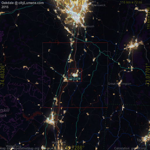
Analysis of Oakdale night lights 2016
Square area 10x10 km:
 1.82%
1.82%90-99
2.27%80-89
4.55%70-79
3.64%60-69
2.27%50-59
0.91%40-49
1.52%30-39
2.12%20-29
3.79%10-19
20.15%0-9
56.97%Square area 50x50 km:
0.11%90-99
0.2%80-89
0.58%70-79
0.39%60-69
0.42%50-59
0.53%40-49
0.52%30-39
0.51%20-29
0.7%10-19
1.1%0-9
94.94%Clear (daylight) street map image can be seen on geolist.org.
Map coordinates:
42° 46' 10.2" North, 74° 28' 59.7" West
42° 15' 4.3" North, 73° 46' 48.5" West
41° 43' 43" North, 73° 4' 37.2" West
Some cities around Oakdale sort by population:
• Albany
44.7 km =27.8 mi,  2°
2°
• West Albany
48 km =29.8 mi, 0°
• Pittsfield
49.2 km =30.6 mi,  63°
63°
• Kingston
40.3 km =25 mi,  206°
206°
• Rensselaer
43.6 km =27.1 mi, 4°
• Delmar
41.5 km =25.8 mi,  354°
354°
• Hudson
0.9 km =0.6 mi,  281°
281°
• Marbletown
49.3 km =30.6 mi, 213°
5129540 (p: 8,107)
Sources (retrieved 2019-11-25):
» Earth at Night: Flat Maps 2012, 2016