Hudson night lights from space
Night Light of Hudson (New York) from space (United States) Src. Average luminocity for 10x10km area is 21.6106% and for 50x50km: 3.0979%.
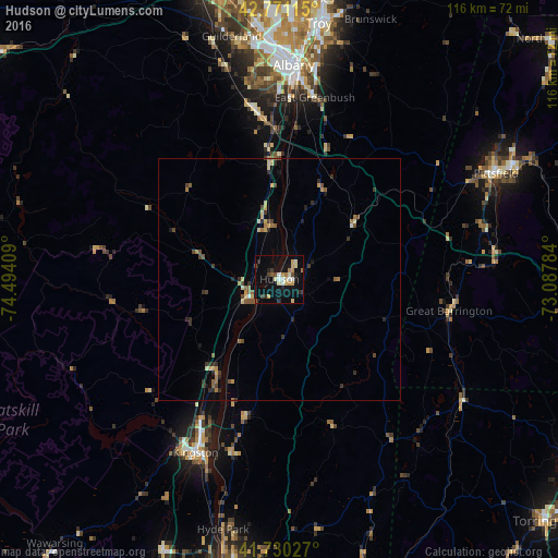
Analysis of Hudson night lights 2016
Square area 10x10 km:
 1.82%
1.82%90-99
2.27%80-89
4.55%70-79
3.64%60-69
2.27%50-59
1.21%40-49
2.42%30-39
1.82%20-29
4.09%10-19
20.3%0-9
55.61%Square area 50x50 km:
0.11%90-99
0.2%80-89
0.58%70-79
0.39%60-69
0.42%50-59
0.53%40-49
0.52%30-39
0.51%20-29
0.7%10-19
1.1%0-9
94.94%Clear (daylight) street map image can be seen on geolist.org.
Map coordinates:
42° 46' 16.1" North, 74° 29' 38.7" West
42° 15' 10.3" North, 73° 47' 27.5" West
41° 43' 49" North, 73° 5' 16.2" West
Some cities around Hudson sort by population:
• Albany
44.5 km =27.7 mi,  3°
3°
• West Albany
47.9 km =29.8 mi, 1°
• Kingston
40 km =24.9 mi,  205°
205°
• Rensselaer
43.5 km =27 mi,  5°
5°
• Delmar
41.2 km =25.6 mi,  355°
355°
• Oakdale
0.9 km =0.6 mi,  101°
101°
• Westmere
49.2 km =30.6 mi,  352°
352°
• Marbletown
48.9 km =30.4 mi, 212°
5121509 (p: 6,436)
Sources (retrieved 2019-11-25):
» Earth at Night: Flat Maps 2012, 2016