North Richland Hills night lights from space
Night Light of North Richland Hills (Texas) from space (United States) Src. Average luminocity for 10x10km area is 94.8811% and for 50x50km: 81.0422%.

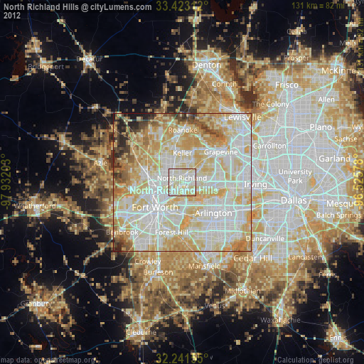
Analysis of North Richland Hills night lights 2016
Square area 10x10 km:
 36.71%
90-99
37.41%80-89
23.25%70-79
2.62%60-69
0%50-59
0%40-49
0%30-39
0%20-29
0%10-19
0%0-9
0%Square area 50x50 km:
25.3%90-99
25.07%80-89
14.34%70-79
10.45%60-69
8.04%50-59
5.19%40-49
3.36%30-39
2.73%20-29
3.15%10-19
2.13%0-9
0.27%Clear (daylight) street map image can be seen on geolist.org.
Map coordinates:
33° 25' 23.2" North, 97° 55' 55.3" West
32° 50' 3.5" North, 97° 13' 44" West
32° 14' 29.6" North, 96° 31' 32.8" West
Some cities around North Richland Hills sort by population:
• Bedford
8.1 km =5 mi,  82°
82°
• Keller
11.4 km =7.1 mi,  349°
349°
• Haltom City
5.4 km =3.4 mi,  224°
224°
• Hurst
5.6 km =3.5 mi,  102°
102°
• Colleyville
8.6 km =5.3 mi,  53°
53°
• Watauga
3.6 km =2.2 mi,  317°
317°
• Saginaw
12.9 km =8 mi,  282°
282°
• Richland Hills
2 km =1.2 mi,  177°
177°
4715292 (p: 69,204)
Sources (retrieved 2019-11-25):
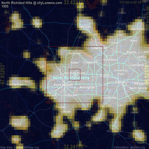
» NASA, Earths city lights 1995
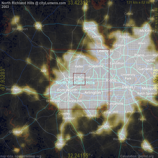
» NASA city lights 2003
» Earth at Night: Flat Maps 2012, 2016